- Created: March 24, 2014 4:00 pm
- Updated: December 12, 2017 10:58 am
- Distance Instructions
- Distance 424 km
- Time 0 s
- Speed 0.0 km/h
- Min altitude 0 m
- Peak 98 m
- Climb 1120 m
- Descent 1115 m


Wild Atlantic Way - County Galway Route Map and Guide
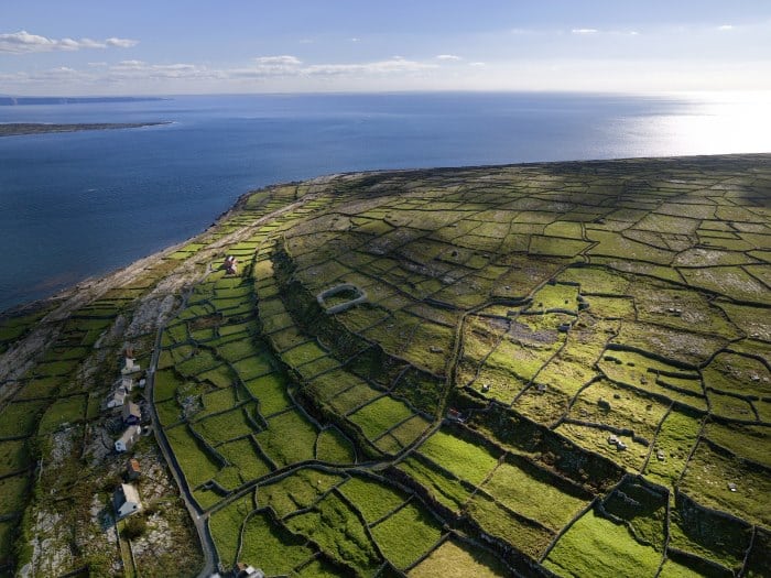
The Co. Galway stage of the Wild Atlantic Way is 300km long and the map is shown below. Starting from the village of Kinvarra on the Galway border it finishes in the village of Leenaun near the Mayo border passing such delights as Dunguaire Castle, the vibrant Galway City known as the City of Tribes, Salthill Promenade, Ferry to the remote Aran Islands, Connemara, Roundstone, Ballyconneely, and the glorious Kylemore Abbey. View the map and Gps directions on our Free App on iPhone and Android
The Wild Atlantic Way drive along the Galway coast takes at least 2 days to complete but 2 weeks would be ideal to properly soak in the county.
- Co. Mayo route - the next stage (north)
If you need to Rent a Car to experience the Wild Atlantic Way then I would suggest visiting www.carhire.ie. If you find a better price elsewhere they will beat it.

Top Attractions on the Galway Stage of the Wild Atlantic Way
The following is a list of the top 40 Attractions and ‘Things to See and Do’ on the Wild Atlantic Way from south to north starting at Kinvarra with plenty more not mentioned here:
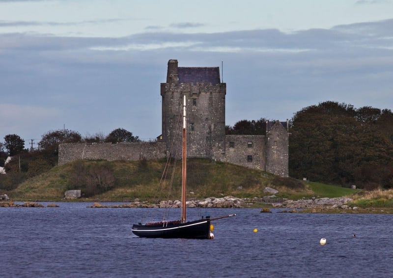
- Kinvarra - Dunguaire Castle and Medieval Banquet
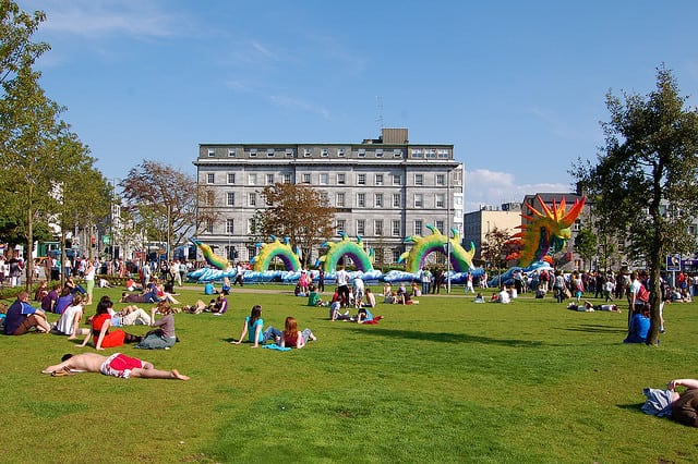
- Galway City, Eyre Square, Spanish Arch, Latin Quarter, Lynch Memorial and Quay Street
- Galway Festivals - Galway Races, Arts Festival, Tedfest Aran Islands - Fr. Ted and others
- Salthill Promenade and Beach
- Spiddal Village and Beach
- Rossaveel and Carraroe Beach
- Lettermore Island
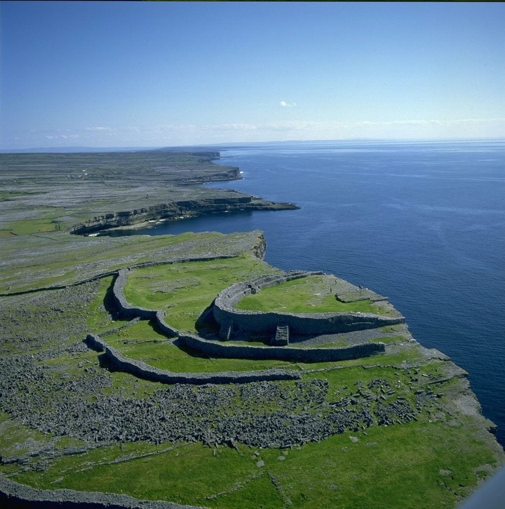
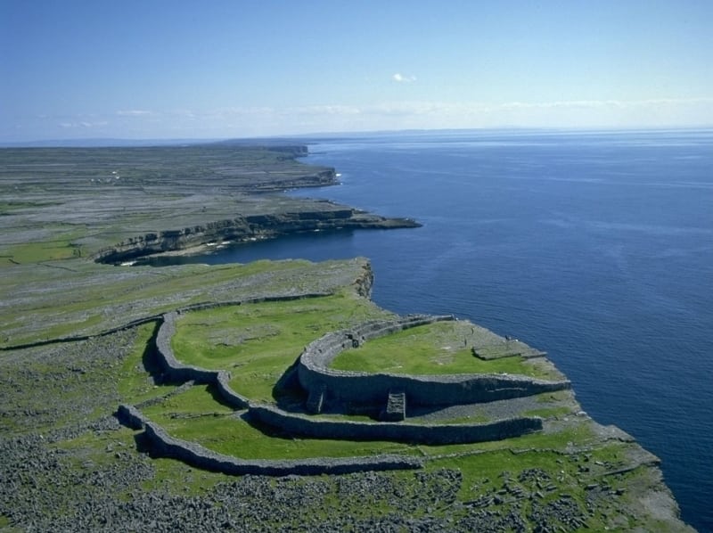
- Ferry or fly to the unique Aran Islands - walking, cycling and more
- Roundstone
- Errisbeag Mountain (300m) Walk for scenic views over Roundstone
- Ballyconneely Beaches and Links Golf Course
- Sky Road Scenic Drive
- Derroura Mountain Bike Trails
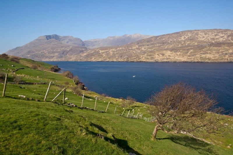
- Killary Harbour
- Horse riding on Connemaras Beaches
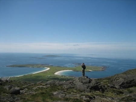
- Connemara National Park
- Glencoaghan Horseshoe Loop Walk, Galway
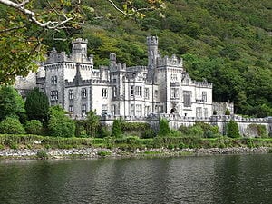
- Kylemore Abbey
- Muckanaght, Benfree and Benbaun Loop Walk, Galway
- Derrigimalagh Bog and Nature Reserve
The Wild Atlantic Way is Irelands long distance scenic driving route along the entire west coast of Ireland from Donegal in the north to Cork in the south. If you are looking for a holiday itinerary from a few days to several weeks, look no further as the Wild Atlantic Way route has it all. From cliff top views to great hikes and from historic cities to picture perfect coastal villages and some of the best surfing in the world, the Wild Atlantic Way drive caters for tourists of all ages and tastes. Slow down and experience the real Ireland.
See the entire Wild Atlantic Way route here
- the Wild Atlantic Way is the longest signed coastal tourist route in the world at approximately 2,750 km (1,700 miles) in length with plenty more side routes and loops.
- You can join the Wild Atlantic Way at any number of points along its length, complete it in either direction and enjoy the many shorter side loops and dozens of attractions, walks, cycles, golf, fishing, surfing, swimming and places to stay and see along the Wild Atlantic Way.
- A map of the Wild Atlantic Way is shown below and you can also download the gpx file (GPS) for your cars Sat Nav or follow it using GPS on our FREE Travel Guide App called ActiveMe Ireland on iPhone and Android App
Wild Atlantic Way – County Galway Route Map and Guide
The Co. Galway stage of the Wild Atlantic Way is 300km long and the map is shown below. Starting from the village of Kinvarra on the Galway border it finishes in the village of Leenaun near the Mayo border passing such delights as Dunguaire Castle, the vibrant Galway City known as the City of Tribes, Salthill Promenade, Ferry to the remote Aran Islands, Connemara, Roundstone, Ballyconneely, and the glorious Kylemore Abbey. View the map and Gps directions on our Free App on iPhone and Android
The Wild Atlantic Way drive along the Galway coast takes at least 2 days to complete but 2 weeks would be ideal to properly soak in the county.
– Co. Mayo route – the next stage (north)
If you need to Rent a Car to experience the Wild Atlantic Way then I would suggest visiting www.carhire.ie. If you find a better price elsewhere they will beat it.
Top Attractions on the Galway Stage of the Wild Atlantic Way
The following is a list of the top 40 Attractions and ‘Things to See and Do’ on the Wild Atlantic Way from south to north starting at Kinvarra with plenty more not mentioned here:
- Kinvarra – Dunguaire Castle and Medieval Banquet
- Galway City, Eyre Square, Spanish Arch, Latin Quarter, Lynch Memorial and Quay Street
- Galway Festivals – Galway Races, Arts Festival, Tedfest Aran Islands – Fr. Ted and others
- Salthill Promenade and Beach
- Spiddal Village and Beach
- Rossaveel and Carraroe Beach
- Lettermore Island
- Ferry or fly to the unique Aran Islands – walking, cycling and more
- Roundstone
- Errisbeag Mountain (300m) Walk for scenic views over Roundstone
- Ballyconneely Beaches and Links Golf Course
- Sky Road Scenic Drive
- Derroura Mountain Bike Trails
- Killary Harbour
- Horse riding on Connemaras Beaches
- Connemara National Park
- Glencoaghan Horseshoe Loop Walk, Galway
- Kylemore Abbey
- Muckanaght, Benfree and Benbaun Loop Walk, Galway
- Derrigimalagh Bog and Nature Reserve
The Wild Atlantic Way is Irelands long distance scenic driving route along the entire west coast of Ireland from Donegal in the north to Cork in the south. If you are looking for a holiday itinerary from a few days to several weeks, look no further as the Wild Atlantic Way route has it all. From cliff top views to great hikes and from historic cities to picture perfect coastal villages and some of the best surfing in the world, the Wild Atlantic Way drive caters for tourists of all ages and tastes. Slow down and experience the real Ireland.
See the entire Wild Atlantic Way route here
– the Wild Atlantic Way is the longest signed coastal tourist route in the world at approximately 2,750 km (1,700 miles) in length with plenty more side routes and loops.
– You can join the Wild Atlantic Way at any number of points along its length, complete it in either direction and enjoy the many shorter side loops and dozens of attractions, walks, cycles, golf, fishing, surfing, swimming and places to stay and see along the Wild Atlantic Way.
– A map of the Wild Atlantic Way is shown below and you can also download the gpx file (GPS) for your cars Sat Nav or follow it using GPS on our FREE Travel Guide App called ActiveMe Ireland on iPhone and Android App
