- Created: August 28, 2012 11:32 am
- Updated: December 12, 2017 11:02 am
- Distance Instructions
- Distance 31 km
- Time 0 s
- Speed 0.0 km/h
- Min altitude 3 m
- Peak 149 m
- Climb 449 m
- Descent 476 m
Stage 3 of The Dingle Way walking route is from Annascaul to Dingle. This is a moderate to strenuous 7 to 9 hour (22 km) walking route to Dingle with the majority on quiet back roads, a few steady climbs and spectacular views.
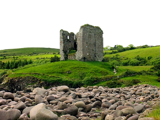
The start of this stage follows the main Dingle road for a very short stretch but care is advised. The route then joins quiet back roads passing the 16th century Minard Castle on the coast and onto the village of Lispole. From here you have a steady climbs to the foothills of Croaghskearda (608m) and An Cnapán Mór (649m) where you contour the mountain slopes before again joining a back road below the famous Conor Pass which leads downhill to the picturesque town of Dingle where great craic is to be had. This route provides stunning views of Dingle Bay, the Iveragh Peninsula and the mountains of the Dingle Peninsula.
The Dingle Way is a long distance trail around the Dingle Peninsula, County Kerry, Ireland. At 162-kilometre (101-mile) long it is one of the longest of Irelands National Waymarked Trails and is typically completed in 8 to 10 days. The walking route officially begins and ends in Tralee but you can join the trail at any number of points along its length. The Dingle Way takes in the entire Dingle Peninsula and is the walking alternative to the great scenic drive around the Dingle Peninsula, a spectacular figure of 8 loop which typically begins and ends in Tralee.
Typically the entire route is broken down into 9 key stages of approximate equal length or duration. We have also broken some of these longer stages into smallers part to allow everyone irrespective of fitness or time available to experience one of the best and varied walks in Ireland.
Use our Map of Ireland and Sat Nav tool to get directions to any of the stage start points and our detailed maps and GPS on our ActiveME App to find and follow the walking route live on screen and keep on track. At all times, our maps and App should be used in conjunction with proper map and compass navigation techniques. Feel free to send us your photos and add you own star rating, comments or suggestions below.
Gallery
Stage 3 of The Dingle Way walking route is from Annascaul to Dingle. This is a moderate to strenuous 7 to 9 hour (22 km) walking route to Dingle with the majority on quiet back roads, a few steady climbs and spectacular views.
The start of this stage follows the main Dingle road for a very short stretch but care is advised. The route then joins quiet back roads passing the 16th century Minard Castle on the coast and onto the village of Lispole. From here you have a steady climbs to the foothills of Croaghskearda (608m) and An Cnapán Mór (649m) where you contour the mountain slopes before again joining a back road below the famous Conor Pass which leads downhill to the picturesque town of Dingle where great craic is to be had. This route provides stunning views of Dingle Bay, the Iveragh Peninsula and the mountains of the Dingle Peninsula.
The Dingle Way is a long distance trail around the Dingle Peninsula, County Kerry, Ireland. At 162-kilometre (101-mile) long it is one of the longest of Irelands National Waymarked Trails and is typically completed in 8 to 10 days. The walking route officially begins and ends in Tralee but you can join the trail at any number of points along its length. The Dingle Way takes in the entire Dingle Peninsula and is the walking alternative to the great scenic drive around the Dingle Peninsula, a spectacular figure of 8 loop which typically begins and ends in Tralee.
Typically the entire route is broken down into 9 key stages of approximate equal length or duration. We have also broken some of these longer stages into smallers part to allow everyone irrespective of fitness or time available to experience one of the best and varied walks in Ireland.
Use our Map of Ireland and Sat Nav tool to get directions to any of the stage start points and our detailed maps and GPS on our ActiveME App to find and follow the walking route live on screen and keep on track. At all times, our maps and App should be used in conjunction with proper map and compass navigation techniques. Feel free to send us your photos and add you own star rating, comments or suggestions below.
