- Created: February 15, 2013 11:33 am
- Updated: December 12, 2017 10:59 am
- Distance Instructions
- Distance 14 km
- Time 0 s
- Speed 0.0 km/h
- Min altitude 44 m
- Peak 695 m
- Climb 872 m
- Descent 871 m
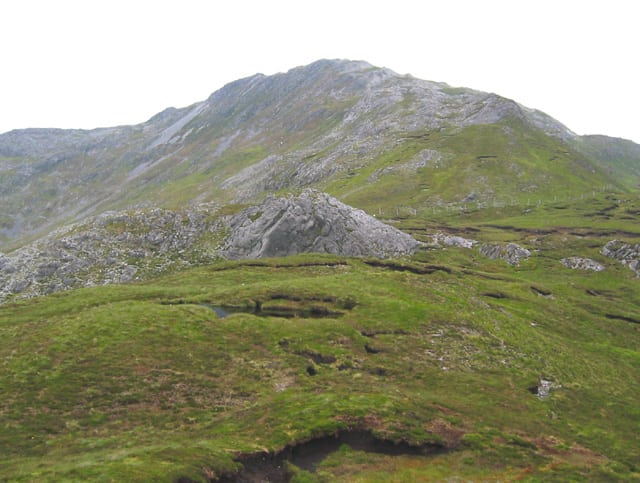
The is a moderate to strenuous 5.5 hour (11 km) walking route to the heart of the Twelve Bens (Pins) Mountains in this isolated, peaceful and beautiful area of Connemara, Co. Galway in the west of Ireland. This great loop trail takes you to the summits of Muckanaght at 654m (2,146 ft), Benfree at 638m (2,093 ft) and the highest of the Bens, Benbaun Mountain at 729m (2,392 ft).
There are plenty of other routes in the area, so find a route that is right for you or your group. Plan your walk by estimating you walking time, checking the weather and the sunrise sunset times on our website https://www.activeme.ie/useful-info/planning-a-trip/ and please remember you are only as fast as the slowest member of your group!
Use our Map of Ireland and Sat Nav tool to get directions to any of the stage start points and our detailed maps and GPS on our ActiveME iPhone and Android App to find and follow the walking route live on screen and keep on track. At all times, our maps and App should be used in conjunction with proper map and compass navigation techniques. Feel free to send us your photos and add you own star rating, comments or suggestions below.
Gallery
The is a moderate to strenuous 5.5 hour (11 km) walking route to the heart of the Twelve Bens (Pins) Mountains in this isolated, peaceful and beautiful area of Connemara, Co. Galway in the west of Ireland. This great loop trail takes you to the summits of Muckanaght at 654m (2,146 ft), Benfree at 638m (2,093 ft) and the highest of the Bens, Benbaun Mountain at 729m (2,392 ft).
There are plenty of other routes in the area, so find a route that is right for you or your group. Plan your walk by estimating you walking time, checking the weather and the sunrise sunset times on our website https://www.activeme.ie/useful-info/planning-a-trip/ and please remember you are only as fast as the slowest member of your group!
Use our Map of Ireland and Sat Nav tool to get directions to any of the stage start points and our detailed maps and GPS on our ActiveME iPhone and Android App to find and follow the walking route live on screen and keep on track. At all times, our maps and App should be used in conjunction with proper map and compass navigation techniques. Feel free to send us your photos and add you own star rating, comments or suggestions below.
