- Created: May 7, 2013 11:34 am
- Updated: December 12, 2017 10:59 am
Categories:
Location: Kerry
- Distance Instructions
Label
- Distance 13 km
- Time 0 s
- Speed 0.0 km/h
- Min altitude 20 m
- Peak 510 m
- Climb 521 m
- Descent 516 m
HELLY HANSEN, 2013 KILLARNEY ADVENTURE RACE
59 KM ROUTE
Stage 5 Torc Mountain Run or Walk - 8.5km
- Start: Dundag Beach on the shores of the Lakes of Killarney
- Finish: Torc Waterfall Transition
- Distance: 8.5Km
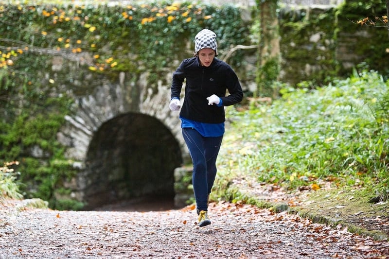
- Description: After the Kayak your mountain Run / Walk awaits. Starting by going under a 250 year old tunnel under the road, competitors will ascend to Torc Waterfall and follow forest tracks to the base of Torc Mountain. From here a mountain track leads to the panoramic views of Killarney national park
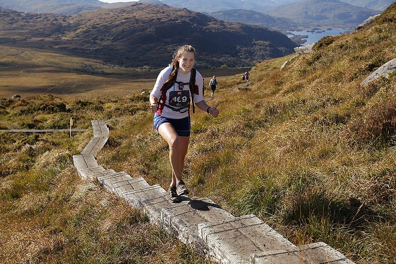
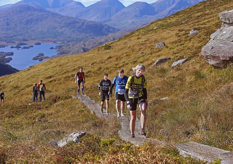
- Terrain: Walking trail, stone steps, forest track, mountain track, railway sleepers.
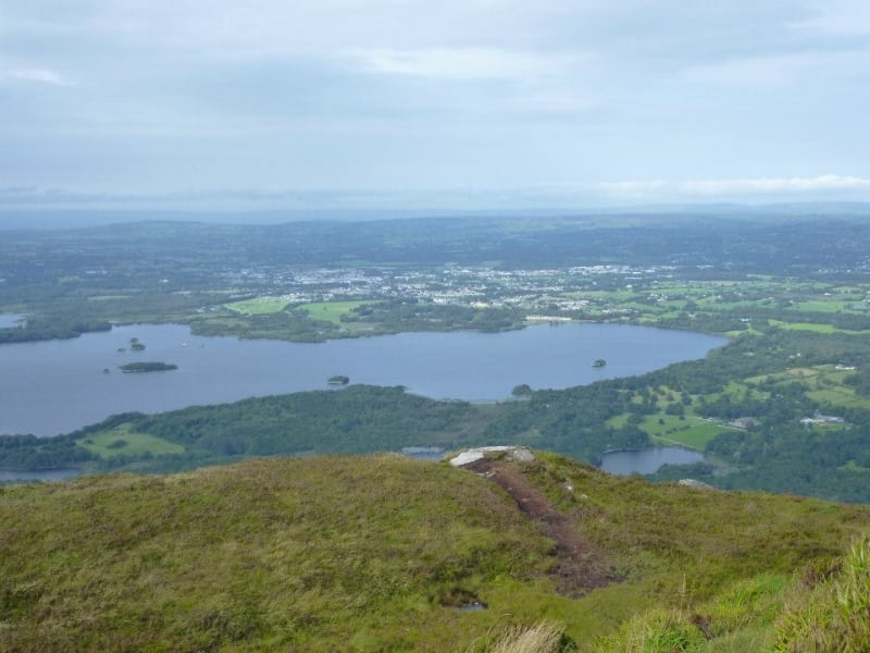
- Features: From the summit you have panoramic views across the entire Killarney National Park, the Lakes of Killarney and as far as Kenmare Bay.
- Precautions: The ascent up the final 50m to the summit of Torc is a steep rock incline and competitors must follow the marked route.
- Cut off point: Competitors who do not reach the base of Torc Mountain by 2.30pm will not be allowed to continue up to the summit.
To see the route, use our Map of Ireland and Sat Nav tools on our website and our GPS maps on our free ActiveME iPhone and Android App to find and follow the route. Feel free to send us your photos and add you own star rating, comments or suggestions below.
HELLY HANSEN, 2013 KILLARNEY ADVENTURE RACE
59 KM ROUTE
Stage 5 Torc Mountain Run or Walk – 8.5km
- Start: Dundag Beach on the shores of the Lakes of Killarney
- Finish: Torc Waterfall Transition
- Distance: 8.5Km
- Description: After the Kayak your mountain Run / Walk awaits. Starting by going under a 250 year old tunnel under the road, competitors will ascend to Torc Waterfall and follow forest tracks to the base of Torc Mountain. From here a mountain track leads to the panoramic views of Killarney national park
- Terrain: Walking trail, stone steps, forest track, mountain track, railway sleepers.
- Features: From the summit you have panoramic views across the entire Killarney National Park, the Lakes of Killarney and as far as Kenmare Bay.
- Precautions: The ascent up the final 50m to the summit of Torc is a steep rock incline and competitors must follow the marked route.
- Cut off point: Competitors who do not reach the base of Torc Mountain by 2.30pm will not be allowed to continue up to the summit.
To see the route, use our Map of Ireland and Sat Nav tools on our website and our GPS maps on our free ActiveME iPhone and Android App to find and follow the route. Feel free to send us your photos and add you own star rating, comments or suggestions below.
