- Created: August 28, 2012 11:32 am
- Updated: December 12, 2017 11:02 am
- Distance Instructions
- Distance 43 km
- Time 0 s
- Speed 0.0 km/h
- Min altitude 7 m
- Peak 193 m
- Climb 579 m
- Descent 576 m
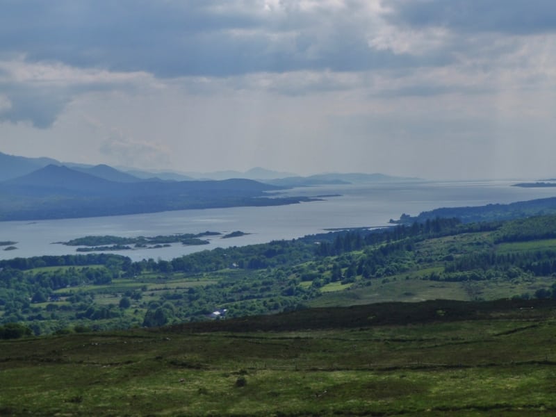
Stage 8 of The Kerry Way long distance walking route is from Sneem to Kenmare. This is a strenuous to difficult 8 to 10 hour (30 km) walking route to Kenmare along undulating hills and one steep crossings of spur of Lacka mountain. This stage can easily be broken into 3 seperate parts to make it easier.
This stage firstly crosses the Sneem River and follows quiet backroads and paths across bogland area to the slopes of Knockanamadane mountain (270m). After this the Kerry Way goes downhill to a small road section and lovely wooded tracks and onto the abandoned 19th century village of Tahilla which in the past was a busy fishing village. From Tahilla the route follows an old road track, wooded paths through Derrenamacken Wood and onto Blackwater Bridge views back across Coongar Harbour and Drongawn Lough.
From here the route again follows wooded paths and the Blackwater River and goes inland passing Dromore Castle built in the 1830's and Cappanacush Castle from the 13th century. The route now follows the main Ring of Kerry road to Templenoe, home of Pat Spillanes Pub, owned by one of Ireland's most renowned Gaelic Football players.
From Templenoe the route ascends to the spur (130m) of Lacka Hill (362m) crossing the Reen River and again the Kerry Way route climbs Gortamullin Hill (205m) with great views of the Caha Mountains on the Beara Peninsula. From here the route goes back downhill to picturesque town of Kenmare where you can visit the ancient 4,000 year-old Reenagoppul Stone Circle near the town centre.
The Kerry Way is a long distance walking trail in County Kerry, Ireland and the longest of Irelands National Waymarked Trails at approximately 215 km (134 miles) long. The walking route officially begins and ends in Killarney but you can join the trail at any number of points along its length. The Kerry Way takes in the entire Iveragh Peninsula in an anti clockwise loop and is the walking alternative to the world famous Ring of Kerry scenic drive which follows a similar route.
Typically the entire route is broken down into 9 key stages of approximate equal length or duration. We have also broken some of these longer stages into smallers part to allow everyone irrespective of fitness or time available to experience one of the best and varied walks in Ireland.
Use our Map of Ireland and Sat Nav tool to get directions to any of the stage start points and our detailed maps and GPS on our ActiveME App to find and follow the walking route live on screen and keep on track.
Gallery
Stage 8 of The Kerry Way long distance walking route is from Sneem to Kenmare. This is a strenuous to difficult 8 to 10 hour (30 km) walking route to Kenmare along undulating hills and one steep crossings of spur of Lacka mountain. This stage can easily be broken into 3 seperate parts to make it easier.
This stage firstly crosses the Sneem River and follows quiet backroads and paths across bogland area to the slopes of Knockanamadane mountain (270m). After this the Kerry Way goes downhill to a small road section and lovely wooded tracks and onto the abandoned 19th century village of Tahilla which in the past was a busy fishing village. From Tahilla the route follows an old road track, wooded paths through Derrenamacken Wood and onto Blackwater Bridge views back across Coongar Harbour and Drongawn Lough.
From here the route again follows wooded paths and the Blackwater River and goes inland passing Dromore Castle built in the 1830’s and Cappanacush Castle from the 13th century. The route now follows the main Ring of Kerry road to Templenoe, home of Pat Spillanes Pub, owned by one of Ireland’s most renowned Gaelic Football players.
From Templenoe the route ascends to the spur (130m) of Lacka Hill (362m) crossing the Reen River and again the Kerry Way route climbs Gortamullin Hill (205m) with great views of the Caha Mountains on the Beara Peninsula. From here the route goes back downhill to picturesque town of Kenmare where you can visit the ancient 4,000 year-old Reenagoppul Stone Circle near the town centre.
The Kerry Way is a long distance walking trail in County Kerry, Ireland and the longest of Irelands National Waymarked Trails at approximately 215 km (134 miles) long. The walking route officially begins and ends in Killarney but you can join the trail at any number of points along its length. The Kerry Way takes in the entire Iveragh Peninsula in an anti clockwise loop and is the walking alternative to the world famous Ring of Kerry scenic drive which follows a similar route.
Typically the entire route is broken down into 9 key stages of approximate equal length or duration. We have also broken some of these longer stages into smallers part to allow everyone irrespective of fitness or time available to experience one of the best and varied walks in Ireland.
Use our Map of Ireland and Sat Nav tool to get directions to any of the stage start points and our detailed maps and GPS on our ActiveME App to find and follow the walking route live on screen and keep on track.
