- Created: August 28, 2012 11:32 am
- Updated: December 12, 2017 11:02 am
- Distance Instructions
- Distance 13 km
- Time 0 s
- Speed 0.0 km/h
- Min altitude 7 m
- Peak 193 m
- Climb 260 m
- Descent 256 m
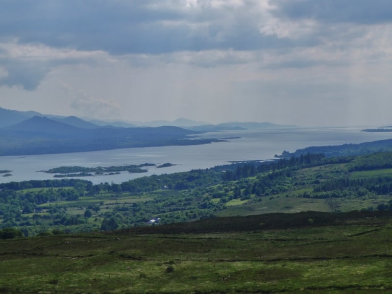
Part 4 of Stage 8 on the Kerry Way is from Templenoe to Kenmare, County Kerry, Ireland. It is an moderate 3.5 hour (8.5 km) walk from the village of Templenoe to Kenmare with a short section on the main Ring of Kerry road and a walk to the summit of Gortamullin Mountain (205m) overlooking Kenmare.
From Templenoe the route ascends to the spur (130m) of Lacka Hill (362m) crossing the Reen River and again the Kerry Way route climbs Gortamullin Hill (205m) with great views of the Caha Mountains on the Beara Peninsula. From here the route goes back downhill to picturesque town of Kenmare where you can visit the great pubs, restaurants, shops and ancient 4,000 year-old Reenagoppul Stone Circle near the town centre.
The Kerry Way is a long distance walking trail in County Kerry, Irelandand the longest of Irelands National Waymarked Trails at approximately 215 km (134 miles) long. The walking route officially begins and ends in Killarney but you can join the trail at any number of points along its length. The Kerry Way takes in the entire Iveragh Peninsula in an anti clockwise loop and is the walking alternative to the world famous Ring of Kerry scenic drive which follows a similar route.Typically the entire route is broken down into 9 key stages of approximate equal length or duration. We have also broken some of these longer stages into smallers part to allow everyone irrespective of fitness or time available to experience one of the best and varied walks in Ireland.
Gallery
Part 4 of Stage 8 on the Kerry Way is from Templenoe to Kenmare, County Kerry, Ireland. It is an moderate 3.5 hour (8.5 km) walk from the village of Templenoe to Kenmare with a short section on the main Ring of Kerry road and a walk to the summit of Gortamullin Mountain (205m) overlooking Kenmare.
From Templenoe the route ascends to the spur (130m) of Lacka Hill (362m) crossing the Reen River and again the Kerry Way route climbs Gortamullin Hill (205m) with great views of the Caha Mountains on the Beara Peninsula. From here the route goes back downhill to picturesque town of Kenmare where you can visit the great pubs, restaurants, shops and ancient 4,000 year-old Reenagoppul Stone Circle near the town centre.
The Kerry Way is a long distance walking trail in County Kerry, Irelandand the longest of Irelands National Waymarked Trails at approximately 215 km (134 miles) long. The walking route officially begins and ends in Killarney but you can join the trail at any number of points along its length. The Kerry Way takes in the entire Iveragh Peninsula in an anti clockwise loop and is the walking alternative to the world famous Ring of Kerry scenic drive which follows a similar route.Typically the entire route is broken down into 9 key stages of approximate equal length or duration. We have also broken some of these longer stages into smallers part to allow everyone irrespective of fitness or time available to experience one of the best and varied walks in Ireland.
