- Created: August 28, 2012 11:32 am
- Updated: December 12, 2017 11:02 am
- Distance Instructions
- Distance 15 km
- Time 0 s
- Speed 0.0 km/h
- Min altitude 9 m
- Peak 195 m
- Climb 255 m
- Descent 293 m
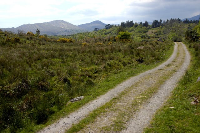
Stage 7 - Part 2 of The Kerry Way long distance walking route is from Staigue River to Sneem, County Kerry, Ireland. This is a moderate 4.5 hour (11 km) walking route to Sneem along some quiet country roads with stunning scenery of the coast and Kenmare Bay.
From Staigue River, this walking route follows an old coach road with small sections of boggy track with views of Staigue Stone Fort below to the north. After crossing the ridge at Ardmore (201m), the Kerry Way descends through some woodland until you are back onto quiet county roads before crossing the Bunnow River and again climbing the slopes of Esknaloughoge (377m). The remaining section of this walk is straightforward and varies between quiet back roads, boggy sections, woodland and obvious tracks until you reach the beautiful and colourful village of Sneem.
The Kerry Way is a long distance walking trail in County Kerry, Ireland and the longest of Irelands National Waymarked Trails at approximately 215 km (134 miles) long. The walking route officially begins and ends in Killarney but you can join the trail at any number of points along its length. The Kerry Way takes in the entire Iveragh Peninsula in an anti clockwise loop and is the walking alternative to the world famous Ring of Kerry scenic drive which follows a similar route. Typically the entire route is broken down into 9 key stages of approximate equal length or duration. We have also broken some of these longer stages into these smallers parts to allow everyone irrespective of fitness or time available to experience one of the best and varied walks in Ireland.
Gallery
Stage 7 – Part 2 of The Kerry Way long distance walking route is from Staigue River to Sneem, County Kerry, Ireland. This is a moderate 4.5 hour (11 km) walking route to Sneem along some quiet country roads with stunning scenery of the coast and Kenmare Bay.
From Staigue River, this walking route follows an old coach road with small sections of boggy track with views of Staigue Stone Fort below to the north. After crossing the ridge at Ardmore (201m), the Kerry Way descends through some woodland until you are back onto quiet county roads before crossing the Bunnow River and again climbing the slopes of Esknaloughoge (377m). The remaining section of this walk is straightforward and varies between quiet back roads, boggy sections, woodland and obvious tracks until you reach the beautiful and colourful village of Sneem.
The Kerry Way is a long distance walking trail in County Kerry, Ireland and the longest of Irelands National Waymarked Trails at approximately 215 km (134 miles) long. The walking route officially begins and ends in Killarney but you can join the trail at any number of points along its length. The Kerry Way takes in the entire Iveragh Peninsula in an anti clockwise loop and is the walking alternative to the world famous Ring of Kerry scenic drive which follows a similar route. Typically the entire route is broken down into 9 key stages of approximate equal length or duration. We have also broken some of these longer stages into these smallers parts to allow everyone irrespective of fitness or time available to experience one of the best and varied walks in Ireland.
