- Created: August 28, 2012 11:32 am
- Updated: December 12, 2017 11:02 am
- Distance Instructions
- Distance 16 km
- Time 0 s
- Speed 0.0 km/h
- Min altitude 71 m
- Peak 296 m
- Climb 396 m
- Descent 367 m
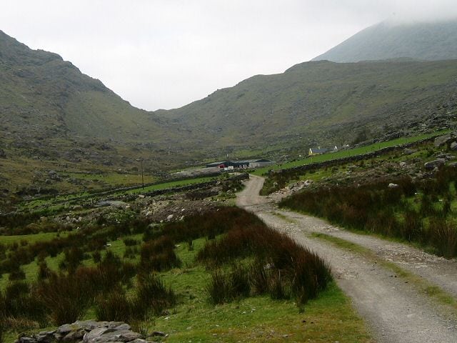
The first part of Stage 2 on the Kerry Way is moderate walk from the Black Valley to the Bridia Valley along lovely walking paths and quiet country lanes.
The Kerry Way is an amazing long distance walking trail in County Kerry, Ireland and the longest of Irelands National Waymarked Trails at approximately 215 km (134 miles) long. The walking route officially begins and ends in Killarney but you can join the trail at any number of points along its length. The Kerry Way takes in the entire Iveragh Peninsula in an anti clockwise loop and is the walking alternative to the world famous Ring of Kerry scenic drive which follows a similar route.
It is the most popular signposted loop trails in Ireland and one of the worlds most spectacular and diverse walks taking 7 to 10 days to complete, crossing varied and spectacular terrain with overnight stops camping in this wild terrain or in the great towns and villages on the world famous Ring of Kerry.
Typically the entire route is broken down into 9 key stages of approximate equal length or duration. We have also broken some of these longer stages into smallers part to allow everyone irrespective of fitness or time available to experience one of the best and varied walks in Ireland.
Use our Map of Ireland and Sat Nav tool to get directions to any of the stage start points and our detailed maps and GPS on our ActiveME App to find and follow the walking route live on screen and keep on track. At all times, our maps and Apps should be used in conjunction proper map and compass navigation techniques. Feel free to send us your photos and add you own star rating, comments or suggestions below.
Gallery
The first part of Stage 2 on the Kerry Way is moderate walk from the Black Valley to the Bridia Valley along lovely walking paths and quiet country lanes.
The Kerry Way is an amazing long distance walking trail in County Kerry, Ireland and the longest of Irelands National Waymarked Trails at approximately 215 km (134 miles) long. The walking route officially begins and ends in Killarney but you can join the trail at any number of points along its length. The Kerry Way takes in the entire Iveragh Peninsula in an anti clockwise loop and is the walking alternative to the world famous Ring of Kerry scenic drive which follows a similar route.
It is the most popular signposted loop trails in Ireland and one of the worlds most spectacular and diverse walks taking 7 to 10 days to complete, crossing varied and spectacular terrain with overnight stops camping in this wild terrain or in the great towns and villages on the world famous Ring of Kerry.
Typically the entire route is broken down into 9 key stages of approximate equal length or duration. We have also broken some of these longer stages into smallers part to allow everyone irrespective of fitness or time available to experience one of the best and varied walks in Ireland.
Use our Map of Ireland and Sat Nav tool to get directions to any of the stage start points and our detailed maps and GPS on our ActiveME App to find and follow the walking route live on screen and keep on track. At all times, our maps and Apps should be used in conjunction proper map and compass navigation techniques. Feel free to send us your photos and add you own star rating, comments or suggestions below.
