- Created: August 28, 2012 10:33 am
- Updated: May 25, 2022 10:01 am
- Distance Instructions
- Distance 21 km
- Time 0 s
- Speed 0.0 km/h
- Min altitude 148 m
- Peak 917 m
- Climb 780 m
- Descent 781 m
The Lugnaquilla Mountain from Glenmalure Loop Walk is a strenuous but rewarding 6 to 7 hour (15 km) walking route to the summit of the ever popular Lugnaquilla Mountain (925m) from Glenamalure and returning via Cloghernagh (800m). Although not the shortest route to Lugnaquilla (meaning: Hollow of the Wood), it is one of the most scenic and rewarding with panoramic views over the Wicklow Mountains, Glen of Imaal, Glendalough and Glenmalure and views further afield to the Blessington Lakes and if your lucky, across the Irish Sea to the hills of the Llŷn Peninsula and mountains of Snowdonia in Wales and south west to the mountains of Munster.
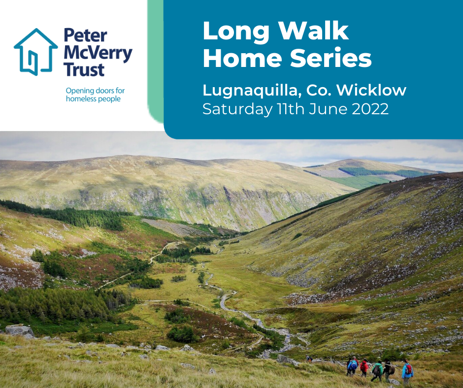
The Peter McVerry Trust Lugnaquilla Climb 2022 is taking place for the first time since 2019 on Saturday 11th June 2022. Each sign up is €50 which includes the guided hike, a Peter McVerry Trust t-shirt, post-hike refreshments and a return bus from Dublin to Wicklow for those that need it. Funds raised by people who sign up will go straight to Peter McVerry Trust, the national housing and homeless charity, to support more people into a home of their own. Click here to book you place and find more information
Irish and mountain weather is nothing but unpredictable and weather, visibility and temperature can change in minutes. At all times, our maps should only be used in conjunction with proper map and compass navigation techniques by experienced mountain hikers. There are plenty of other routes to suit beginners in the area, so please find a route that is right for you or your group or better still hire a guide if unsure. Why take a guide? While you get to experience the thrill of climbing to the summit and admiring the scenery, a guide can help bring the place to life with local history, mythology and stories of the area. Most importantly, a guide knows the route and will give comfort to those with little mountain experience.
Lugnaquilla is the highest moutaain in Ireland outside Co. Kerry and the 13th highest mountain in Ireland. It is very accessible from Dublin City with 3 popular routes to the summit from Glenmalure (this route), Aghavannagh and the Glen of Imaal (shortest route). Lugnaquilla is flanked on two sides by steep glacial corries called North Prison and South Prison. This route starts in the Glenmalure Valley car park close to the nearby hostel and passes the dramatic cliffs of Fraughan Rock Glen and from there takes a short but steep route to the mountain summit. On your return you will pass over Cloghernagh mountain (800m) before descending through lovely woodland before meeting the road where you will turn left and walk to the car park. Other descent Routes can be seen here. Other Walks Nearby include:
- Mullaghcleevaun and Tonelagee Mountain Walk, Wicklow Mountains (16km/6hrs)
- Seefin, Seefingan & Kippure Mountain Loop Walk, Wicklow (15km/5hrs)
- Maulin Mountain Loop Walking Route, Wicklow (9km/3hrs)
- Carrawaystick Mountain Loop Walk, Wicklow (21km/7hrs)
- Glendalough and Camaderry Mountain Loop Walk (12km/4hrs)
- Wicklow Way Walk, Stage 4, Glendalough to Glenmalure (15km/4.5hrs)
- Mullacor Mountain Loop Walk, Wicklow Mountains (14km/4.5hrs)
- Scarr and Kanturk Mountain Loop Walk, Wicklow Mountains (20km/7.5hrs)
- Wicklow Way Walk, Stage 3, Roundwood to Glendalough (13km/4hrs)
- Fancy and Djouce Mountain Loop Walk, Wicklow Mountains (14km/5.5hrs)
- Great Sugar Loaf Mountain Walking Route, Wicklow Mountains (3km/1.5hrs)
- Wicklow Way Walk, Stage 2, Knockree to Roundwood (21km/6.5hrs)
- Tonduff and Maulin Mountains Loop Walk, Wicklow Mountains (11.5km/4.5hrs)
- Crone to Powerscourt Waterfall overlook walk, Wicklow (7.5km/2.5hrs)
- Maulin and Djouce Mountain Walking Loop, Wicklow Mountains (16.5km/5.5hrs)
- Glendalough Loop Walk over the Spinc, White Route, Wicklow (10km/3.5hrs)
- Seefingan & Kippure Mountain Loop Walk, Wicklow Mountains (15km/5hrs)
- Glen of Imaal Loop Walk (Artillery Range), Wicklow (19km/7hrs)

- Places to Stay Nearby: coming soon
- Places for Food Nearby: coming soon
- Places for Entertainment Nearby: coming soon
- Local Walking Guide or Tour Guide: coming soon
- Local Transport or Bike Hire: coming soon
- Other greats Things to See and Do in the Area: coming soon
If you need to Rent a Car to experience Lugnaquilla Mountain then I would suggest visiting www.carhire.ie. If you find a better price elsewhere they will beat it.

Plan your walk by checking the weather, sunrise sunset times and our hiking checklist on our website https://www.activeme.ie/useful-info/planning-a-trip/. Please remember that you are only as fast as the slowest member of your group! If the weather is poor don't be afraid to cancel your walk and do some other walk, maybe a low level walk.
Use our Map of Ireland and Sat Nav tool to get directions to the start point. Lughnaquilla is notoriously featureless on its summit and in times of cloud and fog, visibility can become a navigation issue. At all times, our maps and App should only be used in conjunction with proper map and compass navigation techniques and if unsure, just hire a guide or choose another walk.
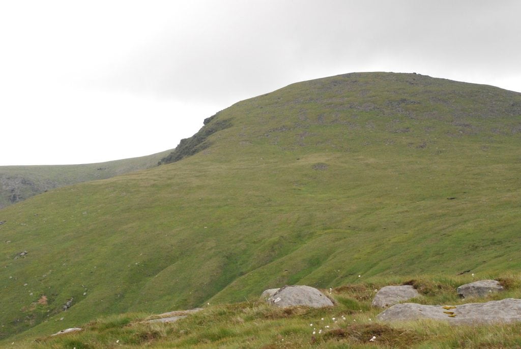
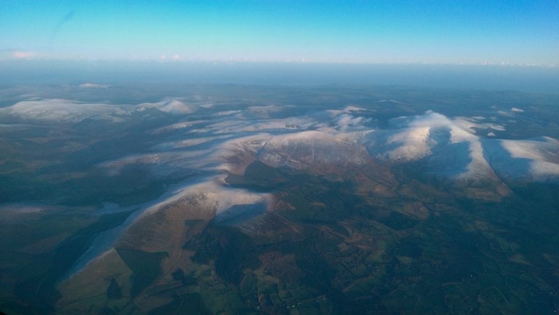
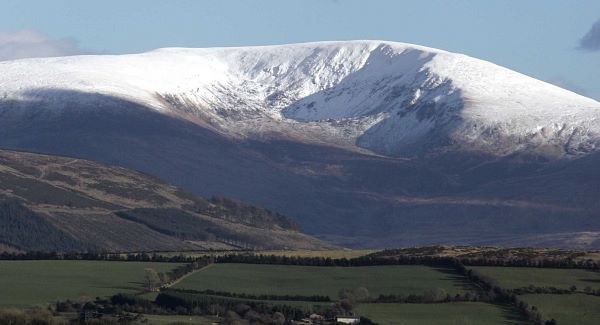
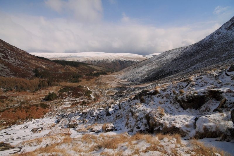
Gallery
The Lugnaquilla Mountain from Glenmalure Loop Walk is a strenuous but rewarding 6 to 7 hour (15 km) walking route to the summit of the ever popular Lugnaquilla Mountain (925m) from Glenamalure and returning via Cloghernagh (800m). Although not the shortest route to Lugnaquilla (meaning: Hollow of the Wood), it is one of the most scenic and rewarding with panoramic views over the Wicklow Mountains, Glen of Imaal, Glendalough and Glenmalure and views further afield to the Blessington Lakes and if your lucky, across the Irish Sea to the hills of the Llŷn Peninsula and mountains of Snowdonia in Wales and south west to the mountains of Munster.
The Peter McVerry Trust Lugnaquilla Climb 2022 is taking place for the first time since 2019 on Saturday 11th June 2022. Each sign up is €50 which includes the guided hike, a Peter McVerry Trust t-shirt, post-hike refreshments and a return bus from Dublin to Wicklow for those that need it. Funds raised by people who sign up will go straight to Peter McVerry Trust, the national housing and homeless charity, to support more people into a home of their own. Click here to book you place and find more information
Irish and mountain weather is nothing but unpredictable and weather, visibility and temperature can change in minutes. At all times, our maps should only be used in conjunction with proper map and compass navigation techniques by experienced mountain hikers. There are plenty of other routes to suit beginners in the area, so please find a route that is right for you or your group or better still hire a guide if unsure. Why take a guide? While you get to experience the thrill of climbing to the summit and admiring the scenery, a guide can help bring the place to life with local history, mythology and stories of the area. Most importantly, a guide knows the route and will give comfort to those with little mountain experience.
Lugnaquilla is the highest moutaain in Ireland outside Co. Kerry and the 13th highest mountain in Ireland. It is very accessible from Dublin City with 3 popular routes to the summit from Glenmalure (this route), Aghavannagh and the Glen of Imaal (shortest route). Lugnaquilla is flanked on two sides by steep glacial corries called North Prison and South Prison. This route starts in the Glenmalure Valley car park close to the nearby hostel and passes the dramatic cliffs of Fraughan Rock Glen and from there takes a short but steep route to the mountain summit. On your return you will pass over Cloghernagh mountain (800m) before descending through lovely woodland before meeting the road where you will turn left and walk to the car park. Other descent Routes can be seen here. Other Walks Nearby include:
- Mullaghcleevaun and Tonelagee Mountain Walk, Wicklow Mountains (16km/6hrs)
- Seefin, Seefingan & Kippure Mountain Loop Walk, Wicklow (15km/5hrs)
- Maulin Mountain Loop Walking Route, Wicklow (9km/3hrs)
- Carrawaystick Mountain Loop Walk, Wicklow (21km/7hrs)
- Glendalough and Camaderry Mountain Loop Walk (12km/4hrs)
- Wicklow Way Walk, Stage 4, Glendalough to Glenmalure (15km/4.5hrs)
- Mullacor Mountain Loop Walk, Wicklow Mountains (14km/4.5hrs)
- Scarr and Kanturk Mountain Loop Walk, Wicklow Mountains (20km/7.5hrs)
- Wicklow Way Walk, Stage 3, Roundwood to Glendalough (13km/4hrs)
- Fancy and Djouce Mountain Loop Walk, Wicklow Mountains (14km/5.5hrs)
- Great Sugar Loaf Mountain Walking Route, Wicklow Mountains (3km/1.5hrs)
- Wicklow Way Walk, Stage 2, Knockree to Roundwood (21km/6.5hrs)
- Tonduff and Maulin Mountains Loop Walk, Wicklow Mountains (11.5km/4.5hrs)
- Crone to Powerscourt Waterfall overlook walk, Wicklow (7.5km/2.5hrs)
- Maulin and Djouce Mountain Walking Loop, Wicklow Mountains (16.5km/5.5hrs)
- Glendalough Loop Walk over the Spinc, White Route, Wicklow (10km/3.5hrs)
- Seefingan & Kippure Mountain Loop Walk, Wicklow Mountains (15km/5hrs)
- Glen of Imaal Loop Walk (Artillery Range), Wicklow (19km/7hrs)
- Places to Stay Nearby: coming soon
- Places for Food Nearby: coming soon
- Places for Entertainment Nearby: coming soon
- Local Walking Guide or Tour Guide: coming soon
- Local Transport or Bike Hire: coming soon
- Other greats Things to See and Do in the Area: coming soon
If you need to Rent a Car to experience Lugnaquilla Mountain then I would suggest visiting www.carhire.ie. If you find a better price elsewhere they will beat it.
Plan your walk by checking the weather, sunrise sunset times and our hiking checklist on our website https://www.activeme.ie/useful-info/planning-a-trip/. Please remember that you are only as fast as the slowest member of your group! If the weather is poor don’t be afraid to cancel your walk and do some other walk, maybe a low level walk.
Use our Map of Ireland and Sat Nav tool to get directions to the start point. Lughnaquilla is notoriously featureless on its summit and in times of cloud and fog, visibility can become a navigation issue. At all times, our maps and App should only be used in conjunction with proper map and compass navigation techniques and if unsure, just hire a guide or choose another walk.
