- Created: January 20, 2014 7:00 pm
- Updated: August 19, 2024 9:49 am
- Distance Instructions
- Distance 155 km
- Time 0 s
- Speed 0.0 km/h
- Min altitude 0 m
- Peak 540 m
- Climb 3470 m
- Descent 3470 m

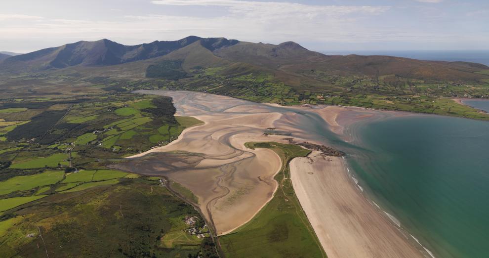
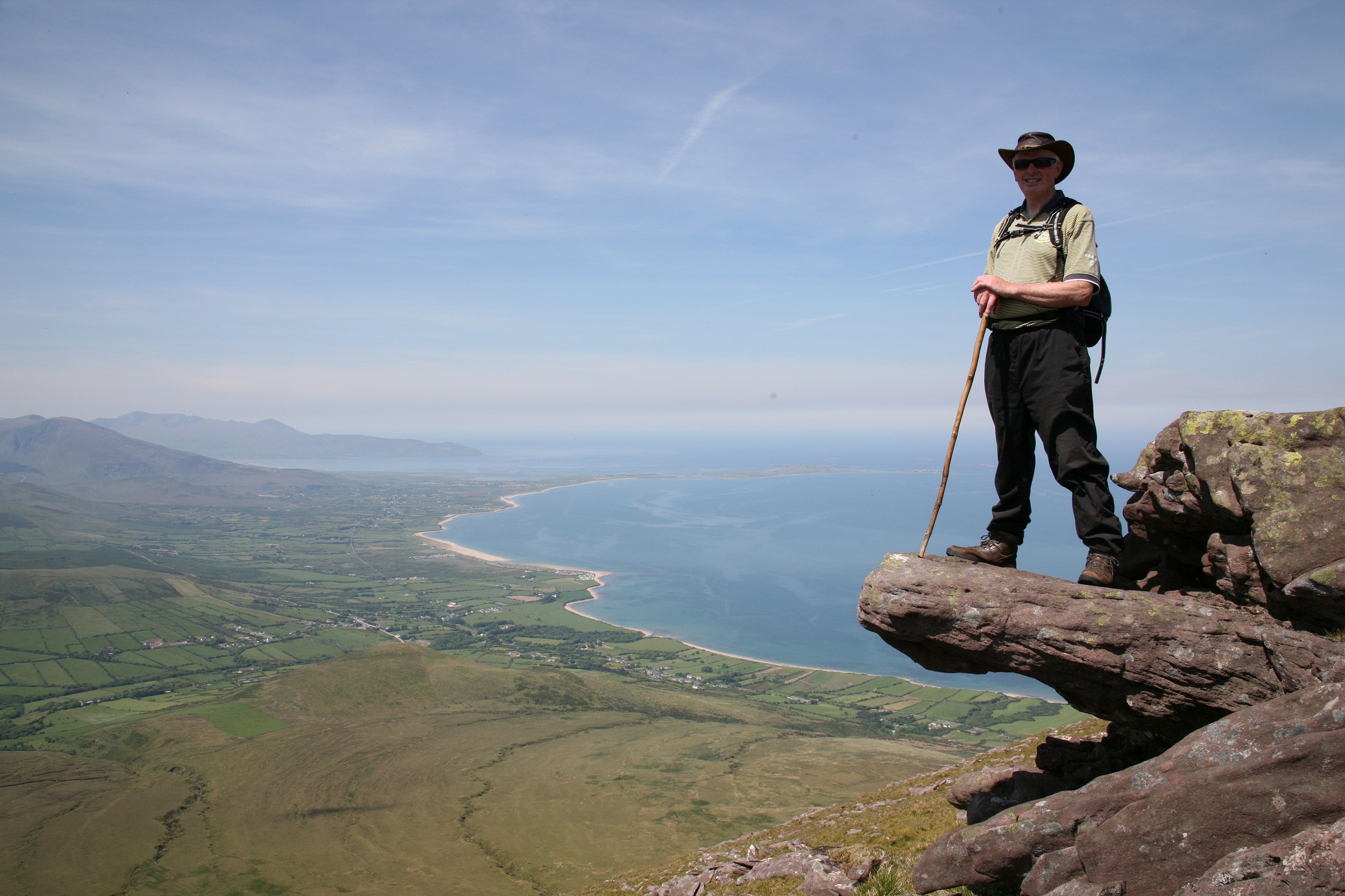
Typically the entire route is broken down into 8 key stages of approximate equal length and estimated duration. We have also broken some of these longer stages into smaller parts to allow everyone irrespective of fitness or time available to experience one of the best and varied walks in Ireland. Use our maps and elevation profiles to gauge the climb on each stage. Plan your holiday including accommodation using the the various Dingle Way stage below and don't worry is you want to break these stages into 2 or 3 parts:
- Stage 1 - Tralee Town To Camp Village - 19km (4-6 hours)
- Stage 2 - Camp to Annascaul Village - 18km (4-6 hours)
- Stage 3 - Annascaul to Dingle - 22km (5-8 hours)
- Stage 4 - Dingle to Dunquin (Dún Chaoin) - 20km (4-6 hours)
- Stage 5 - Dunquin to Ballycurrane (before the Brandon Mountain range) - 23km (5-8 hours)
- Stage 6 - Ballycurrane to Cloghane - 21km (6-9 hours)
- Stage 7 - Cloghane to Castlegregory - 26km (5-8 hours)
- Stage 8 - Castlegregory to Tralee - 28km (6-9 hours)
Use our Map of Ireland and Sat Nav tool to get directions to any of the stage start points and our detailed maps and GPS on our ActiveME App to find and follow the walking route live on screen and keep on track. At all times, our maps and Apps should be used in conjunction proper map and compass navigation techniques. Feel free to send us your photos and add you own star rating, comments or suggestions below.
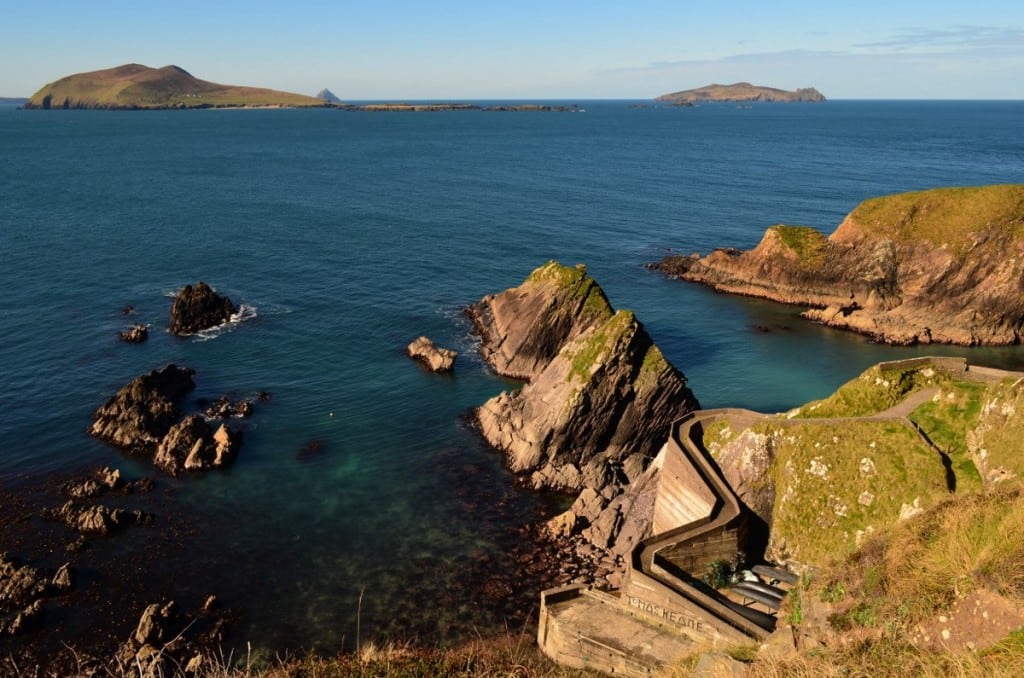
With the Brandon and Sliabh Mish Mountains extending along the peninsula, there are also some great mountain hikes and Loop Walks along the Dingle Way route which allow you to explore the local area if you are staying longer. There are great overnight accommodation options and places to eat in the picturesque towns and villages all along the route, making your journey that much better. Luggage transfer and packed lunch services are also available from many of the accommodation providers.
Accommodation along the Dingle Way Walking Trail (coming soon)
- Tralee
- Camp
- Annascaul
- Dingle
- Dunquin (Dún Chaoin)
- Ballyferriter and Ballycurrane
- Cloghane and Brandon
- Castlegregory
Places to Eat along the Dingle Way (coming soon)
- Tralee
- Camp
- Annascaul
- Dingle
- Dunquin (Dún Chaoin)
- Ballyferriter and Ballycurrane
- Cloghane and Brandon
- Castlegregory
Typically the entire route is broken down into 8 key stages of approximate equal length and estimated duration. We have also broken some of these longer stages into smaller parts to allow everyone irrespective of fitness or time available to experience one of the best and varied walks in Ireland. Use our maps and elevation profiles to gauge the climb on each stage. Plan your holiday including accommodation using the the various Dingle Way stage below and don’t worry is you want to break these stages into 2 or 3 parts:
- Stage 1 – Tralee Town To Camp Village – 19km (4-6 hours)
- Stage 2 – Camp to Annascaul Village – 18km (4-6 hours)
- Stage 3 – Annascaul to Dingle – 22km (5-8 hours)
- Stage 4 – Dingle to Dunquin (Dún Chaoin) – 20km (4-6 hours)
- Stage 5 – Dunquin to Ballycurrane (before the Brandon Mountain range) – 23km (5-8 hours)
- Stage 6 – Ballycurrane to Cloghane – 21km (6-9 hours)
- Stage 7 – Cloghane to Castlegregory – 26km (5-8 hours)
- Stage 8 – Castlegregory to Tralee – 28km (6-9 hours)
Use our Map of Ireland and Sat Nav tool to get directions to any of the stage start points and our detailed maps and GPS on our ActiveME App to find and follow the walking route live on screen and keep on track. At all times, our maps and Apps should be used in conjunction proper map and compass navigation techniques. Feel free to send us your photos and add you own star rating, comments or suggestions below.
With the Brandon and Sliabh Mish Mountains extending along the peninsula, there are also some great mountain hikes and Loop Walks along the Dingle Way route which allow you to explore the local area if you are staying longer. There are great overnight accommodation options and places to eat in the picturesque towns and villages all along the route, making your journey that much better. Luggage transfer and packed lunch services are also available from many of the accommodation providers.
Accommodation along the Dingle Way Walking Trail (coming soon)
- Tralee
- Camp
- Annascaul
- Dingle
- Dunquin (Dún Chaoin)
- Ballyferriter and Ballycurrane
- Cloghane and Brandon
- Castlegregory
Places to Eat along the Dingle Way (coming soon)
- Tralee
- Camp
- Annascaul
- Dingle
- Dunquin (Dún Chaoin)
- Ballyferriter and Ballycurrane
- Cloghane and Brandon
- Castlegregory
