- Created: August 28, 2012 10:32 am
- Updated: December 12, 2017 11:02 am
- Distance Instructions
- Distance 6 km
- Time 0 s
- Speed 0.0 km/h
- Min altitude 8 m
- Peak 127 m
- Climb 142 m
- Descent 26 m
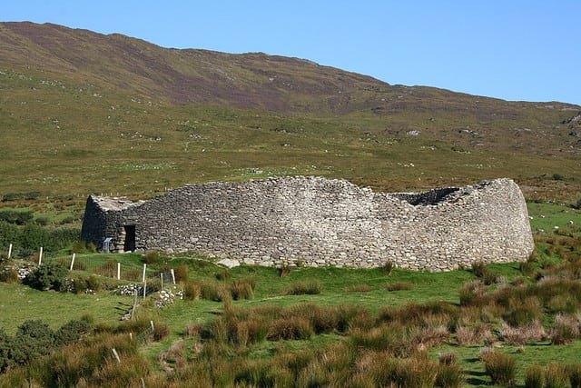
Castle Cove to Staigue Fort is an easy 2 hour (5 km) walk from Castlecove on the Ring of Kerry to the spectacular and historic Staigue Stone Fort. This route follows quiet back roads, coastal paths and woodland tracks to the famous and impressive Staigue Fort. This route also provides stunning views of the coastline, Kenmare Bay and on into the distant valleys.
Use our Map of Ireland and Sat Nav tool to get directions to the start point and our detailed maps and GPS on our ActiveME App to find and follow the route live on screen and keep on track. At all times, our maps and App should be used in conjunction with proper map and compass navigation techniques. Feel free to send us your photos and add you own star rating, comments or suggestions below.
Gallery
Castle Cove to Staigue Fort is an easy 2 hour (5 km) walk from Castlecove on the Ring of Kerry to the spectacular and historic Staigue Stone Fort. This route follows quiet back roads, coastal paths and woodland tracks to the famous and impressive Staigue Fort. This route also provides stunning views of the coastline, Kenmare Bay and on into the distant valleys.
Use our Map of Ireland and Sat Nav tool to get directions to the start point and our detailed maps and GPS on our ActiveME App to find and follow the route live on screen and keep on track. At all times, our maps and App should be used in conjunction with proper map and compass navigation techniques. Feel free to send us your photos and add you own star rating, comments or suggestions below.
