- Created: March 20, 2014 11:37 am
- Updated: December 12, 2017 10:58 am
- Distance Instructions
- Distance 317 km
- Time 0 s
- Speed 0.0 km/h
- Min altitude 0 m
- Peak 171 m
- Climb 1330 m
- Descent 1321 m
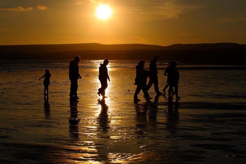
This section of the Wild Atlantic Way is packed with attractions from the world famous Cliffs of Moher and cliff top walk, to the Burren National Park, stunning beaches like Kilkee, to trips with Dolphins and top surf spots.
If you need to Rent a Car to experience the Wild Atlantic Way then I would suggest visiting www.carhire.ie. If you find a better price elsewhere they will beat it.

This Wild Atlantic Way drive along the Clare coast takes at least 2 days to complete. However, you should try to spend at least 2 weeks visiting the top attractions below, meet the local people and experience the real Wild Ireland.
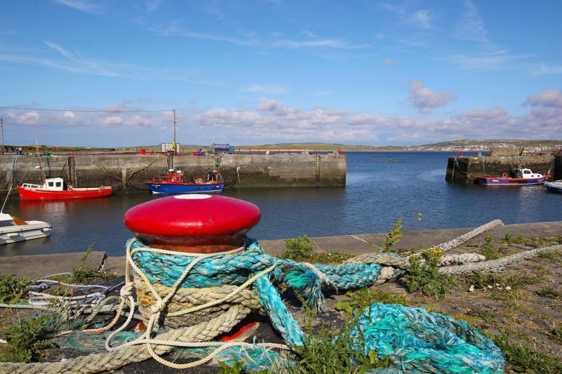
Some of the best towns, villages and islands to visit on the Clare stage of the Wild Atlantic Way traveling south to north include Kilrush, Carrigaholt, Kilkee, Doonbeg, Quilty, Spanish Point, Miltown Malbay, Lahinch, Liscannor, Cliffs of Moher, Doolin Ferry to Aran Islands, Lisdoonvarna, Ballyvaughan and ending in the Galway village of Kinvarra just across the border.
The following is a list of the top 40 Attractions and ‘Things to See and Do’ on the Wild Atlantic Way from south to north starting at the Killimer Ferry with plenty more not mentioned here:
- Kilrush - Shannon Dolphin and Wildlife Centre
- Kilrush - Scattery Island Monastery boat trip
- Kilrush - Vandeleur Walled Garden
- Doonaha beach, lighthouse and fort
- Carrigaholt Castle and Rinevella Beach
- Loop Head Lighthouse
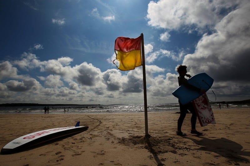
- Killkee - Beach and swim snorkel the pollock holes
- Doonbeg beach, fort and Golf Club
- Kayak to Mutton Island
- Spanish Point Beach
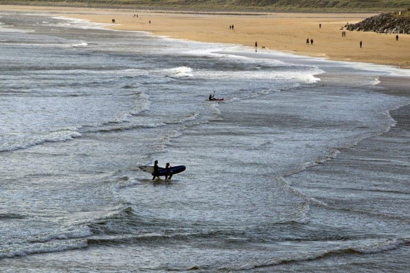
- Surfing and Links Golf in Lahinch
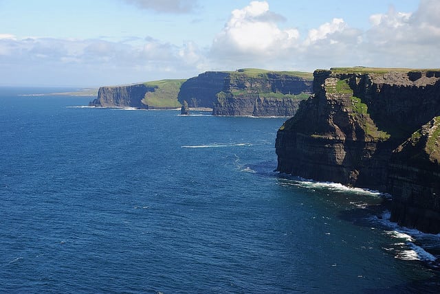
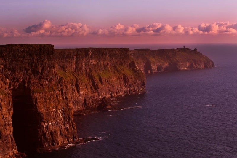
- Cliffs of Moher and cliff walk from Liscannor to Hags Head and Doolin
- Doolin Aran Islands ferry and Doolin Cave
- Lisdoonvarna - Horse Riding and Match Making Festival
- Fanore Beach
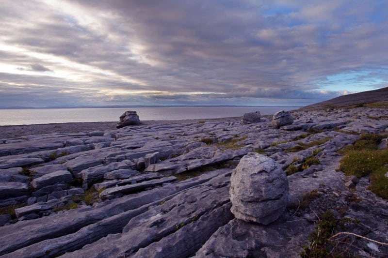
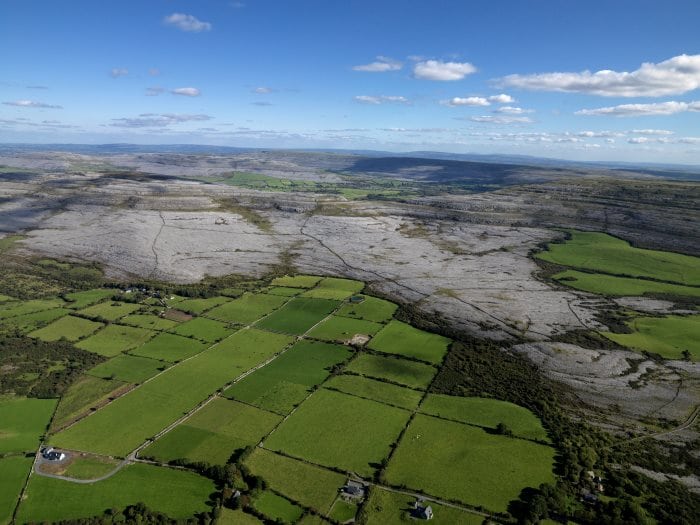
- The Burren National Park - Europe's largest Karst Landscape
- Burren Way Long Distance Walking Trail
- Birds of Prey Centre and Aillwee Cave Ballyvaughan
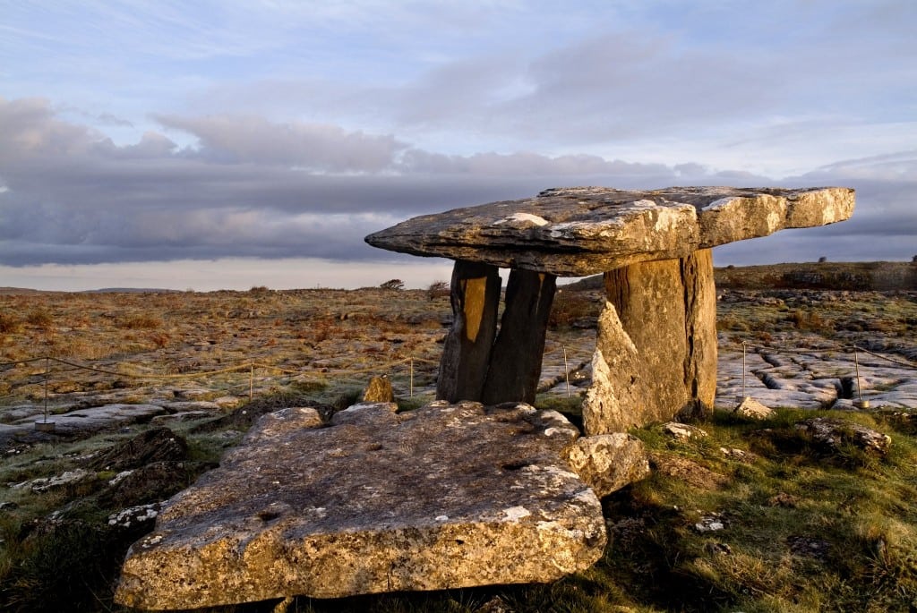
- Poulnabrone Ancient Dolmen, Ballyvaughan
- Bishop's Quarter Beach
The Wild Atlantic Way is Irelands new long distance scenic driving route along the entire west coast of Ireland from Donegal in the north to Cork in the south. If you are looking for a holiday itinerary from a few days to several weeks, look no further as the Wild Atlantic Way route has it all. From cliff top views to great hikes and from historic cities to picture perfect coastal villages and some of the best surfing in the world, the Wild Atlantic Way drive caters for tourists of all ages and tastes. Slow down and experience the real Ireland.
See the entire Wild Atlantic Way route here
- the Wild Atlantic Way is the longest signed coastal tourist route in the world at approximately 2,750 km (1,700 miles) in length with plenty more side routes and loops.
- You can join the Wild Atlantic Way at any number of points along its length, complete it in either direction and enjoy the many shorter side loops and dozens of attractions, walks, cycles, golf, fishing, surfing, swimming and places to stay and see along the Wild Atlantic Way.
- A map of the Wild Atlantic Way is shown below and you can also download the gpx file (GPS) for your cars Sat Nav or follow it using GPS on our FREE Travel Guide App called ActiveMe Ireland on iPhone and Android App
This section of the Wild Atlantic Way is packed with attractions from the world famous Cliffs of Moher and cliff top walk, to the Burren National Park, stunning beaches like Kilkee, to trips with Dolphins and top surf spots.
If you need to Rent a Car to experience the Wild Atlantic Way then I would suggest visiting www.carhire.ie. If you find a better price elsewhere they will beat it.
This Wild Atlantic Way drive along the Clare coast takes at least 2 days to complete. However, you should try to spend at least 2 weeks visiting the top attractions below, meet the local people and experience the real Wild Ireland.
Some of the best towns, villages and islands to visit on the Clare stage of the Wild Atlantic Way traveling south to north include Kilrush, Carrigaholt, Kilkee, Doonbeg, Quilty, Spanish Point, Miltown Malbay, Lahinch, Liscannor, Cliffs of Moher, Doolin Ferry to Aran Islands, Lisdoonvarna, Ballyvaughan and ending in the Galway village of Kinvarra just across the border.
The following is a list of the top 40 Attractions and ‘Things to See and Do’ on the Wild Atlantic Way from south to north starting at the Killimer Ferry with plenty more not mentioned here:
- Kilrush – Shannon Dolphin and Wildlife Centre
- Kilrush – Scattery Island Monastery boat trip
- Kilrush – Vandeleur Walled Garden
- Doonaha beach, lighthouse and fort
- Carrigaholt Castle and Rinevella Beach
- Loop Head Lighthouse
- Killkee – Beach and swim snorkel the pollock holes
- Doonbeg beach, fort and Golf Club
- Kayak to Mutton Island
- Spanish Point Beach
- Surfing and Links Golf in Lahinch
- Cliffs of Moher and cliff walk from Liscannor to Hags Head and Doolin
- Doolin Aran Islands ferry and Doolin Cave
- Lisdoonvarna – Horse Riding and Match Making Festival
- Fanore Beach
- The Burren National Park – Europe’s largest Karst Landscape
- Burren Way Long Distance Walking Trail
- Birds of Prey Centre and Aillwee Cave Ballyvaughan
- Poulnabrone Ancient Dolmen, Ballyvaughan
- Bishop’s Quarter Beach
The Wild Atlantic Way is Irelands new long distance scenic driving route along the entire west coast of Ireland from Donegal in the north to Cork in the south. If you are looking for a holiday itinerary from a few days to several weeks, look no further as the Wild Atlantic Way route has it all. From cliff top views to great hikes and from historic cities to picture perfect coastal villages and some of the best surfing in the world, the Wild Atlantic Way drive caters for tourists of all ages and tastes. Slow down and experience the real Ireland.
See the entire Wild Atlantic Way route here
– the Wild Atlantic Way is the longest signed coastal tourist route in the world at approximately 2,750 km (1,700 miles) in length with plenty more side routes and loops.
– You can join the Wild Atlantic Way at any number of points along its length, complete it in either direction and enjoy the many shorter side loops and dozens of attractions, walks, cycles, golf, fishing, surfing, swimming and places to stay and see along the Wild Atlantic Way.
– A map of the Wild Atlantic Way is shown below and you can also download the gpx file (GPS) for your cars Sat Nav or follow it using GPS on our FREE Travel Guide App called ActiveMe Ireland on iPhone and Android App
