- Created: August 28, 2012 11:32 am
- Updated: December 12, 2017 11:02 am
- Distance Instructions
- Distance 16 km
- Time 0 s
- Speed 0.0 km/h
- Min altitude 127 m
- Peak 996 m
- Climb 1139 m
- Descent 1130 m
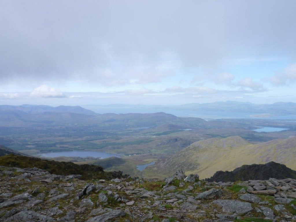
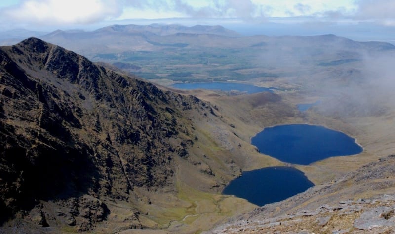
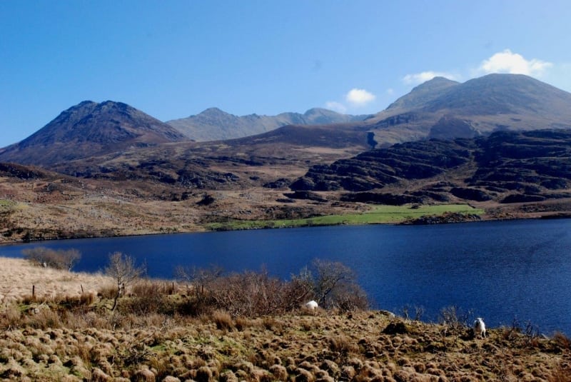
The Coomloughra Horseshoe Loop Walk in Co. Kerry is one of Irelands best ridge walks. It is a strenuous 4 to 5 hour (12 km) hiking trail over several mountain peaks in the MacGillycuddy's Reeks range including 4 of the top 5 highest mountains in Ireland. Be prepared for spectacular scenery if the weather is on your side. The route can be complete in either direction so please view the full route image below, scroll down to see the GPS map and also download our Free iPhone and Android App here.
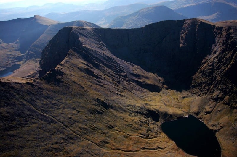
Even in the best weather conditions, this route requires mountain experience, care and some careful scrambling on the notoriously exposed and in some places knife-edged Beenkeragh Ridge between Carrauntoohil and Beenkeragh mountains. You should NOT attempt this route in icy or windy conditions and only complete it during daylight hours. Therefore those who undertake this walk should have mountain experience and have reasonable levels of fitness.
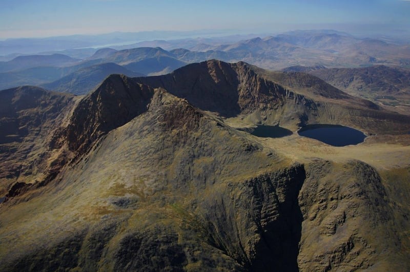
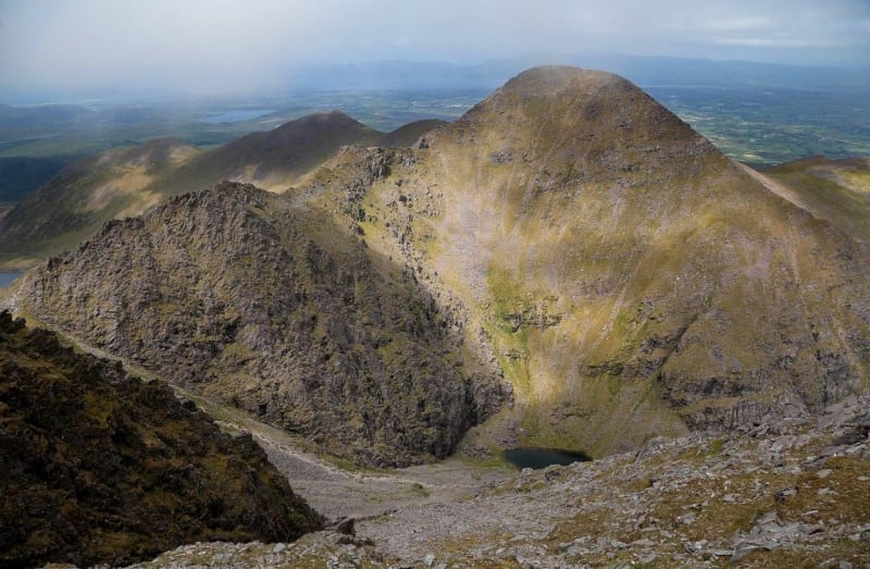
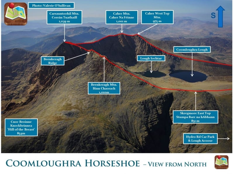
Starting from the new Hydro Road car park, your ascent starts immediately on the Hydro Road. From here you can complete the loop in either direction, with a clockwise direction most popular as you can gain height early on your walk on the steep ascent of Cnoc Íochtair (747m) and Skregmore (848m) and leave the comfortable descent from Caher (1,001) until the end of your walk. From Skregmore (848m), head east on the ridge towards Beenkeragh (1,010m), Ireland's second highest mountain, before turning south to negotiate the Beenkeragh Ridge (as noted above) and finally to the summit of Carrauntoohil (1,039m), Irelands highest mountain.
From the summit of Carrauntoohil (1,039m) head in a southwest direction to pick up the well worn Caher Ridge path and then onto the peaks of Caher (1,001m), Ireland's third highest mountain, and Caher West (975m) before a comfortable descent off the mountains to Lough Eighter and finish again at the Hydro Car park.
There are plenty of other routes to suit beginners to advanced walkers on the Reeks, so please find a route that is right for you or your group. Plan your walk by checking the weather, sunrise sunset times and our hiking checklist on our website https://www.activeme.ie/useful-info/planning-a-trip/. Please remember that you are only as fast as the slowest member of your group! It is also better completed after a spell of dry weather and allow plenty of time.
Use our Map of Ireland and Sat Nav tool to get directions to the start point and our detailed maps and GPS on our ActiveME iPhone App and Android App to find and follow the walking route live on screen and keep on track. Our maps and Apps are only a rough route guide and at all times should be used in conjunction with proper map and compass navigation techniques.
Gallery
The Coomloughra Horseshoe Loop Walk in Co. Kerry is one of Irelands best ridge walks. It is a strenuous 4 to 5 hour (12 km) hiking trail over several mountain peaks in the MacGillycuddy’s Reeks range including 4 of the top 5 highest mountains in Ireland. Be prepared for spectacular scenery if the weather is on your side. The route can be complete in either direction so please view the full route image below, scroll down to see the GPS map and also download our Free iPhone and Android App here.
Even in the best weather conditions, this route requires mountain experience, care and some careful scrambling on the notoriously exposed and in some places knife-edged Beenkeragh Ridge between Carrauntoohil and Beenkeragh mountains. You should NOT attempt this route in icy or windy conditions and only complete it during daylight hours. Therefore those who undertake this walk should have mountain experience and have reasonable levels of fitness.
Starting from the new Hydro Road car park, your ascent starts immediately on the Hydro Road. From here you can complete the loop in either direction, with a clockwise direction most popular as you can gain height early on your walk on the steep ascent of Cnoc Íochtair (747m) and Skregmore (848m) and leave the comfortable descent from Caher (1,001) until the end of your walk. From Skregmore (848m), head east on the ridge towards Beenkeragh (1,010m), Ireland’s second highest mountain, before turning south to negotiate the Beenkeragh Ridge (as noted above) and finally to the summit of Carrauntoohil (1,039m), Irelands highest mountain.
From the summit of Carrauntoohil (1,039m) head in a southwest direction to pick up the well worn Caher Ridge path and then onto the peaks of Caher (1,001m), Ireland’s third highest mountain, and Caher West (975m) before a comfortable descent off the mountains to Lough Eighter and finish again at the Hydro Car park.
There are plenty of other routes to suit beginners to advanced walkers on the Reeks, so please find a route that is right for you or your group. Plan your walk by checking the weather, sunrise sunset times and our hiking checklist on our website https://www.activeme.ie/useful-info/planning-a-trip/. Please remember that you are only as fast as the slowest member of your group! It is also better completed after a spell of dry weather and allow plenty of time.
Use our Map of Ireland and Sat Nav tool to get directions to the start point and our detailed maps and GPS on our ActiveME iPhone App and Android App to find and follow the walking route live on screen and keep on track. Our maps and Apps are only a rough route guide and at all times should be used in conjunction with proper map and compass navigation techniques.
Gallery
