- Created: March 13, 2013 11:38 am
- Updated: December 12, 2017 10:59 am
- Distance Instructions
- Distance 41 km
- Time 0 s
- Speed 0.0 km/h
- Min altitude 101 m
- Peak 828 m
- Climb 2388 m
- Descent 2391 m
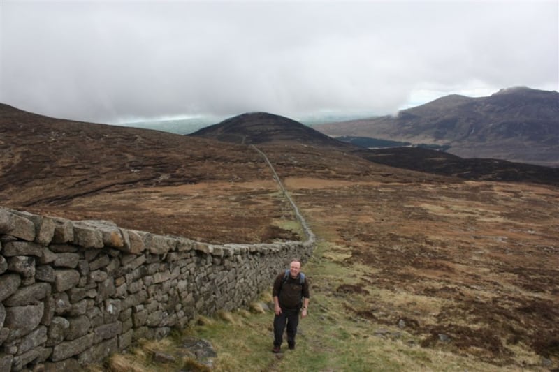
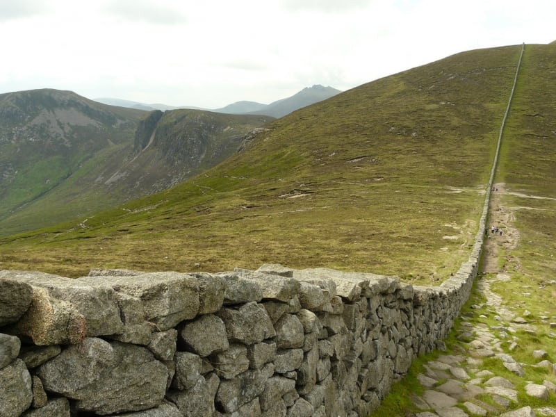
Length: 30km Difficulty: Strenuous. The Mourne Wall Challenge Walk is an amazing but strenuous 9 hour (30km) walking route which follows this famous wall over the Mourne Mountains in Co. Down, Northern Ireland. An organised charity event takes place each year in July.
The wall stretches over 15 peaks of the Mourne Mountains and will take you to arguably some of the most beautiful views in Ireland. This walking challenge may be completed over one day or two. The wall forms a circle which is met at the half way point by the campsite at Meelmore Lodge. The walk climbs Northern Irelands highest and most beautiful mountain, Slieve Donard and en route you will take in stunning views of the County Down coastline and further afield.
The Mourne Wall was a major feat of construction, built between 1904 and 1922 to enclose a catchment area for the water reservoir serving Belfast City. It is a dry stone wall with an average height of 1.5 metres (4 ft 11 in) high and thickness of nearly 1m (3ft). Bar the employment it created at the time, the wall itself is considered pointless. It passes over fifteen mountains (listed clockwise from the Kilkeel River):
- Rocky Mountain 525 m (1,722 ft)
- Slieve Donard 850 m (2,790 ft)
- Slieve Commedagh 765 m (2,510 ft)
- Slieve Corragh 691 m (2,267 ft)
- Slievenaglogh 586 m (1,923 ft)
- Slieve Bearnagh 727 m (2,385 ft)
- Slieve Meelmore 684 m (2,244 ft)
- Slieve Meelbeg 708 m (2,323 ft)
- Slieve Loughshannagh 619 m (2,031 ft)
- Carn Mountain 587 m (1,926 ft)
- Slieve Muck 674 m (2,211 ft)
- Slievenaglogh 445 m (1,460 ft)
- Slieve Binnian 747 m (2,451 ft)
- Wee Binnian 460 m (1,510 ft)
- Moolieve 332 m (1,089 ft)
There are plenty of other routes to suit beginners to advanced walkers in the area, so please find a route that is right for you or your group. Plan your walk by checking the weather, sunrise sunset times and our hiking checklist on our website https://www.activeme.ie/useful-info/planning-a-trip/. Please remember that you are only as fast as the slowest member of your group! It is also better completed after a spell of dry weather and allow plenty of time.
Use our Map of Ireland and Sat Nav tool to get directions to the start point and our detailed maps and GPS on our free ActiveME iPhone App and Android App to find and follow the walking route live on screen and keep on track. At all times, our maps and App should be used in conjunction with proper map and compass navigation techniques. Feel free to send us your photos and add you own star rating, comments or suggestions below.
