- Created: September 28, 2015 8:33 pm
- Updated: December 12, 2017 10:58 am
- Distance Instructions
- Distance 18 km
- Time 0 s
- Speed 0.0 km/h
- Min altitude 130 m
- Peak 729 m
- Climb 770 m
- Descent 770 m
Más an Tiompáin or Masatiompan (763m) is a moderate to strenuous 12.5km (4 hour) walking route from Teer, just outside the coastal village of Cloghane at the foothill of the Brandon Mountains and on the Wild Atlantic Way scenic driving route, Co. Kerry, Ireland. In Irish it means 'rump of the drum/hump/hollow' which suits this lovely rounded mountain. Take the route with you on our free App for iPhone and Android and share your photos on the ActiveMe Facebook and Twitter Pages.
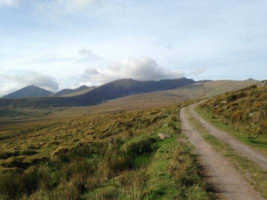
Starting from a handy parking area at Teer (130m), which cuts out the road walk from Cloghane (0m), the first section of the walk follows a minor track road for approx 3.5km until the road/track finishes at a lovely stone built shed with a green roof and a green half door. This shed sits just above the picturesque river valley of Arraglen, the ruins of a old village and a waterfall (just out of sight).
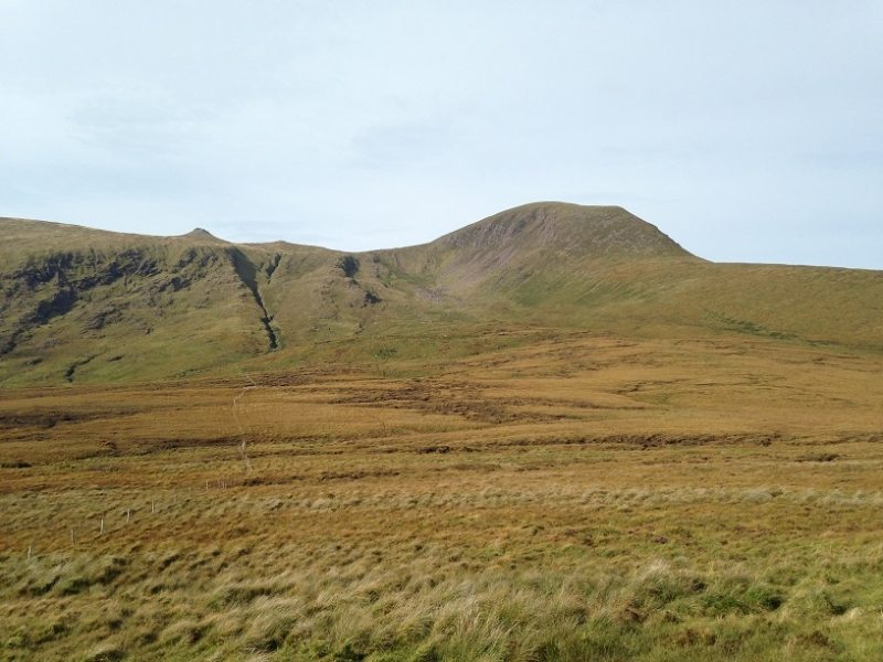
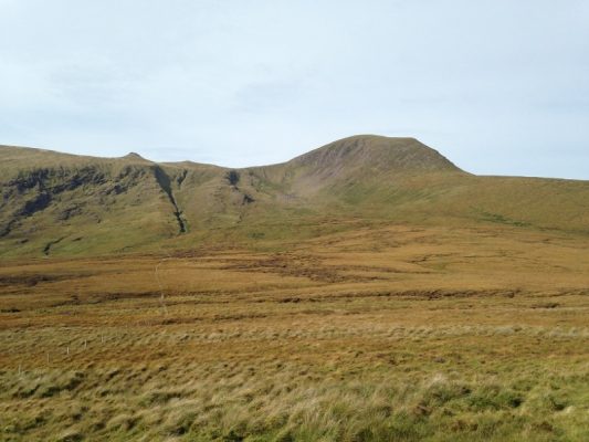
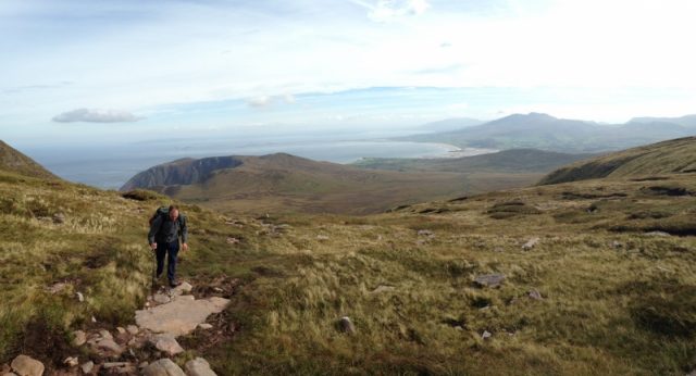
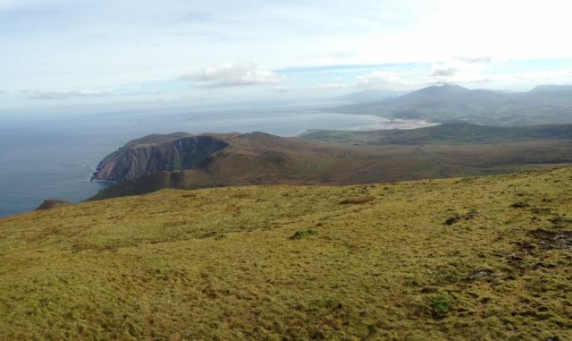
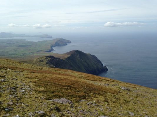
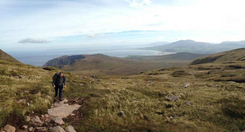
From here you are following a grass path and the signs for the Pilgrims Path/Dingle Way walking trail up towards the saddle between Piaras Mór (748m) on the left of the saddle and Más an Tiompáin (763m) to the right. Following the signposted trail to the saddle you are rising all the time with great views behind you. Behind you from left you right you can see Sás Creek, Brandon and Tralee Bays, The Maharee islands, the Slieve Mish Mountains, Beenoskee Mtn, Conor Pass and the Brandon mountain peaks.
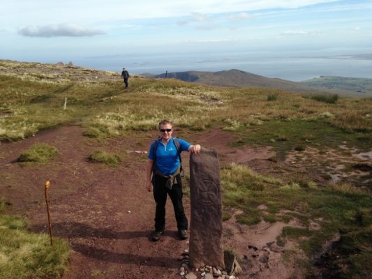
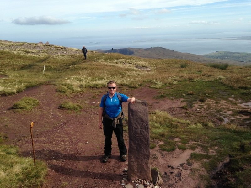
When you reach the ridgeline/saddle you will be greeted by what looks like a standing stone or waymarker on the route but is actually a 1400 year old ancient Ogham Stone from the 6th century, thought to be the highest Ogham stone in Ireland at 653m in the townland Airghleann. The stone, which commands stunning views over the bay has been translated to read 'of the priest Rónán son of Comgánhas'. A Maltese cross one is also found on one side but there are still arguments whether it is Pagan or Christian. Find more detail here.
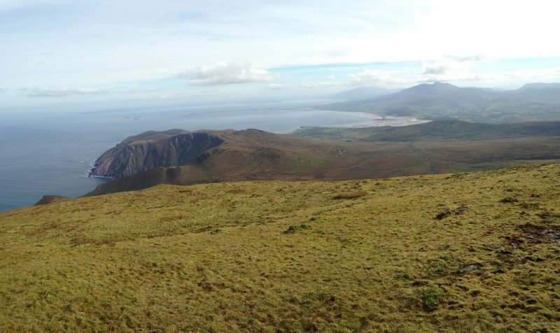
From the Saddle, turn right and climb for approx 20mins to the summit of Más an Tiompáin following the old fence line. At the summit you will be greeted by spectacular 360 degree views:
- view to southwest to Ballydavid Head, Smerwick Harbour, Dingle and further onto the Blasket Islands
- view to the south to Mount Brandon (952m), other peaks on the ridge and onto the Conor Pass in the distance
- view to the west to Sás Creek, Cloghane, Brandon and Tralee Bays, The Maharee islands, Fenit, the Slieve Mish Mountains and Beenoskee Mtn
- view to the north west to Kerry Head and if weather permits, Loop Head Peninsula, Co. Clare.
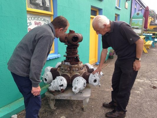
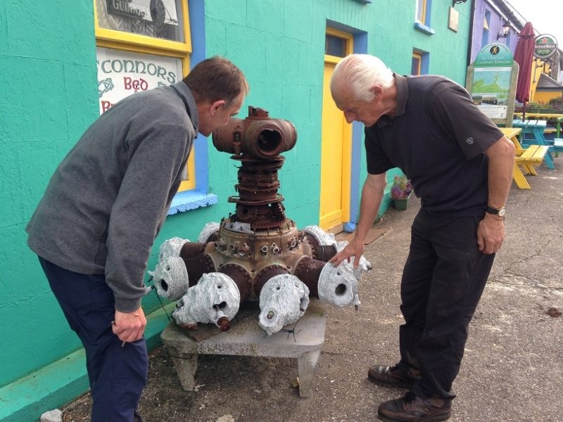
Finish the day with a rest, relax and maybe a pint in the famous O'Connors Pub in Cloghane which you can't miss as there is the old engine of a World War 2 plane out front. This plane along with 4 others, crashed on the Brandon mountains during WW2 and all have sad but amazing stories.
Our map is only a basic guide and is not for navigation. Essential Gear would include Wet gear, fleeces, gloves, map, compass etc.
Más an Tiompáin or Masatiompan (763m) is a moderate to strenuous 12.5km (4 hour) walking route from Teer, just outside the coastal village of Cloghane at the foothill of the Brandon Mountains and on the Wild Atlantic Way scenic driving route, Co. Kerry, Ireland. In Irish it means ‘rump of the drum/hump/hollow’ which suits this lovely rounded mountain. Take the route with you on our free App for iPhone and Android and share your photos on the ActiveMe Facebook and Twitter Pages.
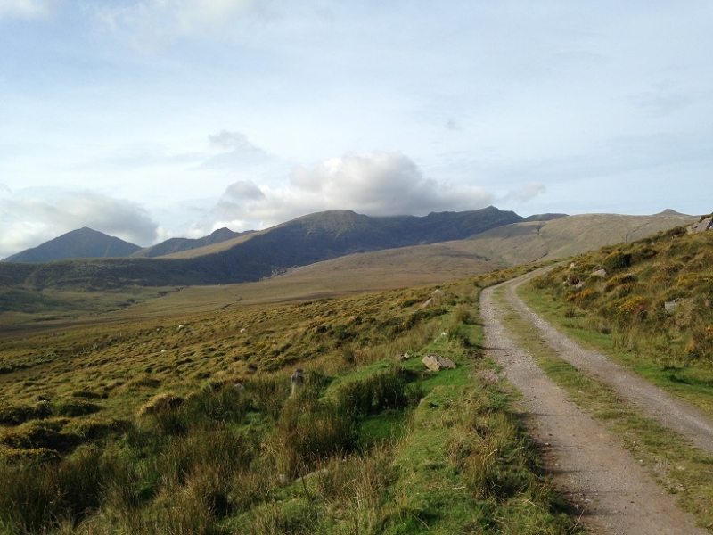
Starting from a handy parking area at Teer (130m), which cuts out the road walk from Cloghane (0m), the first section of the walk follows a minor track road for approx 3.5km until the road/track finishes at a lovely stone built shed with a green roof and a green half door. This shed sits just above the picturesque river valley of Arraglen, the ruins of a old village and a waterfall (just out of sight).

From here you are following a grass path and the signs for the Pilgrims Path/Dingle Way walking trail up towards the saddle between Piaras Mór (748m) on the left of the saddle and Más an Tiompáin (763m) to the right. Following the signposted trail to the saddle you are rising all the time with great views behind you. Behind you from left you right you can see Sás Creek, Brandon and Tralee Bays, The Maharee islands, the Slieve Mish Mountains, Beenoskee Mtn, Conor Pass and the Brandon mountain peaks.
When you reach the ridgeline/saddle you will be greeted by what looks like a standing stone or waymarker on the route but is actually a 1400 year old ancient Ogham Stone from the 6th century, thought to be the highest Ogham stone in Ireland at 653m in the townland Airghleann. The stone, which commands stunning views over the bay has been translated to read ‘of the priest Rónán son of Comgánhas’. A Maltese cross one is also found on one side but there are still arguments whether it is Pagan or Christian. Find more detail here.
From the Saddle, turn right and climb for approx 20mins to the summit of Más an Tiompáin following the old fence line. At the summit you will be greeted by spectacular 360 degree views:
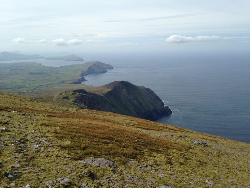
- view to southwest to Ballydavid Head, Smerwick Harbour, Dingle and further onto the Blasket Islands
- view to the south to Mount Brandon (952m), other peaks on the ridge and onto the Conor Pass in the distance
- view to the west to Sás Creek, Cloghane, Brandon and Tralee Bays, The Maharee islands, Fenit, the Slieve Mish Mountains and Beenoskee Mtn
- view to the north west to Kerry Head and if weather permits, Loop Head Peninsula, Co. Clare.
Finish the day with a rest, relax and maybe a pint in the famous O’Connors Pub in Cloghane which you can’t miss as there is the old engine of a World War 2 plane out front. This plane along with 4 others, crashed on the Brandon mountains during WW2 and all have sad but amazing stories.
Our map is only a basic guide and is not for navigation. Essential Gear would include Wet gear, fleeces, gloves, map, compass etc.

