- Created: August 28, 2012 11:32 am
- Updated: December 12, 2017 11:02 am
- Distance Instructions
- Distance 17 km
- Time 0 s
- Speed 0.0 km/h
- Min altitude 146 m
- Peak 833 m
- Climb 795 m
- Descent 794 m
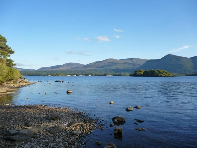
The Mangerton and Stoompa Mountain Loop is a strenuous 5 hour (13.5 km) walking route to the peaks of both Mangerton (839m) and Stoompa Mountain (705m) taking in the Devils Punchbowl, Horses Glen and the Tooreencormick Battle Field Site near Killarney, County Kerry in the south west of Ireland. The walk has spectacular views of the Devil’s Punchbowl, MacGillycuddy’s Reeks, Horses Glen, Killarney National Park and on a good day south west to Kenmare Bay.
According to Irish Mythology and local legend, when local chieftain O’Donoghue Ross dined with the Devil one evening he punched him in the face. As O’Donoghue Ross was leaving the devil bit off the top of Mangerton Mountain creating the beautiful corrie lake known as the Devil’s Punchbowl. He threw it at the departing chieftain but missed him and it landed in Cashel Tipperary, creating the famous Rock of Cashel.
Use our Map of Ireland and Sat Nav tool to get directions to the start point and our detailed maps and GPS on our ActiveME App to find and follow the walking route live on screen and keep on track. At all times, our maps and App should be used in conjunction with proper map and compass navigation techniques. Feel free to send us your photos and add you own star rating, comments or suggestions below.
Gallery
The Mangerton and Stoompa Mountain Loop is a strenuous 5 hour (13.5 km) walking route to the peaks of both Mangerton (839m) and Stoompa Mountain (705m) taking in the Devils Punchbowl, Horses Glen and the Tooreencormick Battle Field Site near Killarney, County Kerry in the south west of Ireland. The walk has spectacular views of the Devil’s Punchbowl, MacGillycuddy’s Reeks, Horses Glen, Killarney National Park and on a good day south west to Kenmare Bay.
According to Irish Mythology and local legend, when local chieftain O’Donoghue Ross dined with the Devil one evening he punched him in the face. As O’Donoghue Ross was leaving the devil bit off the top of Mangerton Mountain creating the beautiful corrie lake known as the Devil’s Punchbowl. He threw it at the departing chieftain but missed him and it landed in Cashel Tipperary, creating the famous Rock of Cashel.
Use our Map of Ireland and Sat Nav tool to get directions to the start point and our detailed maps and GPS on our ActiveME App to find and follow the walking route live on screen and keep on track. At all times, our maps and App should be used in conjunction with proper map and compass navigation techniques. Feel free to send us your photos and add you own star rating, comments or suggestions below.
