- Created: August 28, 2012 10:32 am
- Updated: December 12, 2017 11:02 am
- Distance Instructions
- Distance 19 km
- Time 0 s
- Speed 0.0 km/h
- Min altitude 10 m
- Peak 138 m
- Climb 380 m
- Descent 381 m
The Hogs Head Loop Walk is a moderate 4 to 6 hour (14 km) walking route located just outside Waterville village, County Kerry in the southwest of Ireland. This walking route is along quiet country roads with stunning coastal views at Hogs Head and takes in some of the Kerry Way walking route.
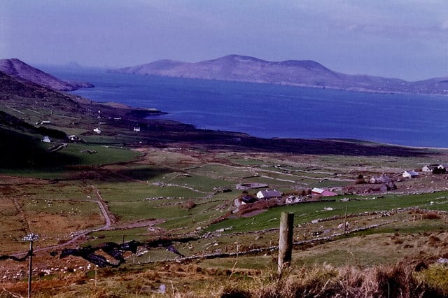
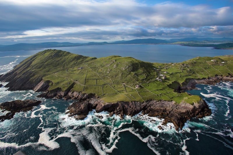
It follows quiet back roads and coastal paths passing a number of ancient stone forts, the most famous of which is the impressive Loher Stone Fort. Loher (Irish: An Lóthar) fort was built by a local chieftan in the early 9th century has dry stone walls up to 3m high in places. This route also provides stunning views of Hogs Head, Ballinskelligs Bay, Bolus Head, the Skelligs, Derrynane Bay and Lambs head and passes through the stunning Derrynane National Park. Photo: Hogs Head by Valerie O'Sullivan.
The Kerry Way is a long distance walking trail in County Kerry, Ireland and the longest of Irelands National Waymarked Trails at approximately 215 km (134 miles) long. The walking route officially begins and ends in Killarney but you can join the trail at any number of points along its length. The Kerry Way takes in the entire Iveragh Peninsula in an anti clockwise loop and is the walking alternative to the world famous Ring of Kerry scenic drive which follows a similar route.
Use our Map of Ireland and Sat Nav tool to get directions to the start point and our detailed maps and GPS on our ActiveME App to find and follow the walking route live on screen and keep on track.
Gallery
The Hogs Head Loop Walk is a moderate 4 to 6 hour (14 km) walking route located just outside Waterville village, County Kerry in the southwest of Ireland. This walking route is along quiet country roads with stunning coastal views at Hogs Head and takes in some of the Kerry Way walking route.
It follows quiet back roads and coastal paths passing a number of ancient stone forts, the most famous of which is the impressive Loher Stone Fort. Loher (Irish: An Lóthar) fort was built by a local chieftan in the early 9th century has dry stone walls up to 3m high in places. This route also provides stunning views of Hogs Head, Ballinskelligs Bay, Bolus Head, the Skelligs, Derrynane Bay and Lambs head and passes through the stunning Derrynane National Park. Photo: Hogs Head by Valerie O’Sullivan.
The Kerry Way is a long distance walking trail in County Kerry, Ireland and the longest of Irelands National Waymarked Trails at approximately 215 km (134 miles) long. The walking route officially begins and ends in Killarney but you can join the trail at any number of points along its length. The Kerry Way takes in the entire Iveragh Peninsula in an anti clockwise loop and is the walking alternative to the world famous Ring of Kerry scenic drive which follows a similar route.
Use our Map of Ireland and Sat Nav tool to get directions to the start point and our detailed maps and GPS on our ActiveME App to find and follow the walking route live on screen and keep on track.
