- Created: September 20, 2013 11:33 am
- Updated: June 14, 2021 11:52 am
- Distance Instructions
- Distance 119 km
- Time 0 s
- Speed 0.0 km/h
- Min altitude 2 m
- Peak 195 m
- Climb 334 m
- Descent 365 m

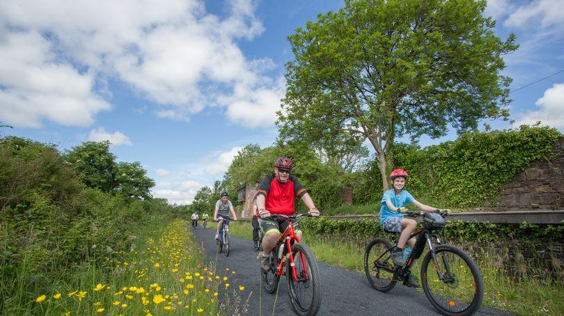
The Limerick Greenway is a 40km off-road walking and cycling route along an old railway line that connects the three market towns of Rathkeale, Newcastle West and Abbeyfeale in West Limerick. The Route follows the old Limerick to Tralee/Fenit railway line which opened in stages between 1867 and 1887 but was closed by 1978.
We promise you a spectacular journey through time, heritage and nature and to give you, the visitor the opportunity to learn more about the people, heritage and environment of one of Ireland’s hidden jewels, West Limerick.
Along this route on Ireland’s Wild Atlantic Way you will find Norman castles, abbeys, medieval ruins, workhouses, famine graveyards, deserted railway stations, a viaduct and breath-taking scenery.
Use this map to help you get the most from the Limerick Greenway, including access points, car parks and attractions in each market town
See www.limerickgreenway.ie for more information, maps and guides
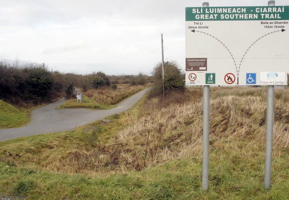
The section within Kerry has yet to open but once complete will add 56km to the route connecting Rathkeale to Tralee. The route will then continue from Tralee onto Fenit which is currently under construction
Gallery
The Limerick Greenway is a 40km off-road walking and cycling route along an old railway line that connects the three market towns of Rathkeale, Newcastle West and Abbeyfeale in West Limerick. The Route follows the old Limerick to Tralee/Fenit railway line which opened in stages between 1867 and 1887 but was closed by 1978.
We promise you a spectacular journey through time, heritage and nature and to give you, the visitor the opportunity to learn more about the people, heritage and environment of one of Ireland’s hidden jewels, West Limerick.
Along this route on Ireland’s Wild Atlantic Way you will find Norman castles, abbeys, medieval ruins, workhouses, famine graveyards, deserted railway stations, a viaduct and breath-taking scenery.
Use this map to help you get the most from the Limerick Greenway, including access points, car parks and attractions in each market town
See www.limerickgreenway.ie for more information, maps and guides
The section within Kerry has yet to open but once complete will add 56km to the route connecting Rathkeale to Tralee. The route will then continue from Tralee onto Fenit which is currently under construction
