- Created: August 28, 2012 10:33 am
- Updated: December 12, 2017 11:01 am
- Distance Instructions
- Distance 41 km
- Time 0 s
- Speed 0.0 km/h
- Min altitude 3 m
- Peak 105 m
- Climb 207 m
- Descent 203 m
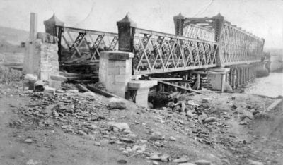
The Letterkenny to Lifford and Strabane Railway opened on 1 January 1909 and closed on 1 January 1960. This narrow gauge rail line was run by the CDR (County Donegal Railways Joint Committee). This line also stopped at Ballindrait, Raphoe and Convoy en route to Letterkenny. This section of disused railway may have the potential to be developed as a walking/cycle route.
Use our Map of Ireland and Sat Nav tool to get directions to any point on the line and our detailed route maps and GPS on our ActiveME App to find and follow the the railway line live on screen and keep on track.
Gallery
The Letterkenny to Lifford and Strabane Railway opened on 1 January 1909 and closed on 1 January 1960. This narrow gauge rail line was run by the CDR (County Donegal Railways Joint Committee). This line also stopped at Ballindrait, Raphoe and Convoy en route to Letterkenny. This section of disused railway may have the potential to be developed as a walking/cycle route.
Use our Map of Ireland and Sat Nav tool to get directions to any point on the line and our detailed route maps and GPS on our ActiveME App to find and follow the the railway line live on screen and keep on track.


