- Created: August 28, 2012 10:33 am
- Updated: December 12, 2017 11:01 am
- Distance Instructions
- Distance 15 km
- Time 0 s
- Speed 0.0 km/h
- Min altitude 2 m
- Peak 39 m
- Climb 39 m
- Descent 41 m
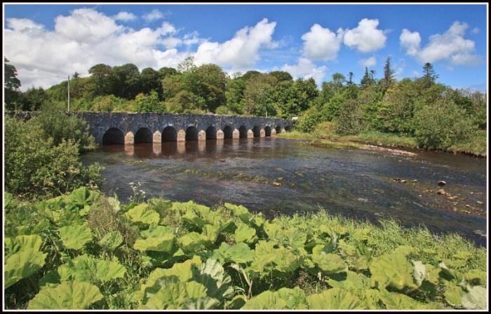
The MGWR's eight mile Ballina Branch Extension to Killala in Co Mayo closed to all traffic in 1934. In Killala itself there are few railway artefacts including a single arch stone railway bridge on your right hand side as you come into the town and the station itself. This section of disused railway may have the potential to be developed as a walking/cycle route.
Use our Map of Ireland and Sat Nav tool to get directions to any point on the line and our detailed maps and GPS on our ActiveME App to find and follow the railway line route live on screen and keep on track.
Gallery
The MGWR’s eight mile Ballina Branch Extension to Killala in Co Mayo closed to all traffic in 1934. In Killala itself there are few railway artefacts including a single arch stone railway bridge on your right hand side as you come into the town and the station itself. This section of disused railway may have the potential to be developed as a walking/cycle route.
Use our Map of Ireland and Sat Nav tool to get directions to any point on the line and our detailed maps and GPS on our ActiveME App to find and follow the railway line route live on screen and keep on track.
