- Created: June 21, 2013 11:55 am
- Updated: December 12, 2017 10:59 am
- Distance Instructions
- Distance 26 km
- Time 0 s
- Speed 0.0 km/h
- Min altitude 1 m
- Peak 167 m
- Climb 620 m
- Descent 609 m
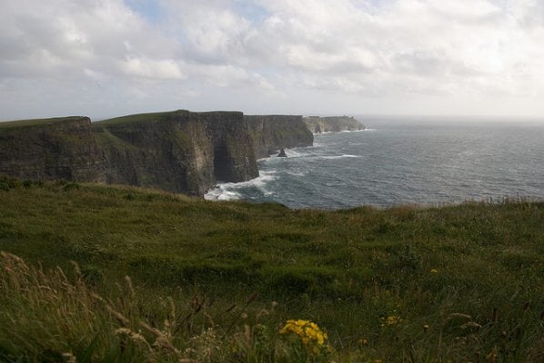
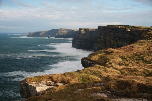
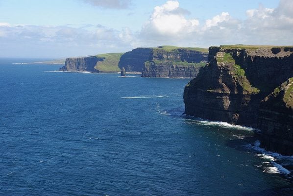
The Cliffs of Moher Coastal Walk is a moderate to strenuous 4 to 6 hour (18 km) walking route along a new spectacular coastal path from Liscannor in the south, to Hags Head and the world famous Cliffs of Moher and Visitor Centre and finishing in the village of Doolin in the north. The walk is fairly flat with only a slight and gradual rise to the higher cliffs. The 6 hour duration allows plenty time to stop for photos, breaks and taking in the scenery with views to the Aran Islands, Galway Bay, Aill Na Searrach and the Atlantic Ocean way below your feet !!!! You can do the entire walk in either direction or just a section of the walk starting at a number of parking areas along the route or from the Cliffs of Moher Visitor Centre itself.
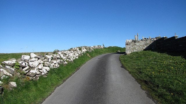
From Liscannor, the trail follows quiet country roads and paths to Hags Head and the signal tower. Either side of the protected cliff top at the Cliffs of Moher centre it follows the remote and exposed cliff top path so care is advised in all weather conditions. Typical duration and distances for route sections are below:
- Liscannor village to the Cliffs of Moher Visitor Centre - 12 km (3 to 4 hours).
- Cliffs of Moher Visitor Centre to Hags Head - 5 km (1.5 to 2 hours).
- Cliffs of Moher Visitor Centre to Moher Sports Field Parking - 6 km (1.5 to 2 hours).
- Cliffs of Moher Visitor Centre to Doolin - 8km (2.5 to 3 hours).
Please not walk the path in poor weather and do not approach the cliff edge. Please supervise children at all times but is not really suitable for children under 12 or bicycles and dogs are forbidden on the trail. The walking trail has been developed with kind assistance of local landowners and organisations. Please respect the landowners, their fencing and their livestock by parking only in designated areas and staying on the official trail.
There are plenty of routes available, so find a route that is right for you or your group. Plan your walk by estimating you walking time, checking the weather and the sunrise sunset times on our website https://www.activeme.ie/useful-info/planning-a-trip/ and please remember you are only as fast as the slowest member of your group!
Use our Map of Ireland and Sat Nav tool to get directions to any of the stage start points and our detailed maps and GPS on our ActiveME iPhone and Android App to find and follow the walking route live on screen and keep on track. At all times, our maps and App should be used in conjunction with proper map and compass navigation techniques. Feel free to send us your photos and add you own star rating, comments or suggestions below.
The Cliffs of Moher Coastal Walk is a moderate to strenuous 4 to 6 hour (18 km) walking route along a new spectacular coastal path from Liscannor in the south, to Hags Head and the world famous Cliffs of Moher and Visitor Centre and finishing in the village of Doolin in the north. The walk is fairly flat with only a slight and gradual rise to the higher cliffs. The 6 hour duration allows plenty time to stop for photos, breaks and taking in the scenery with views to the Aran Islands, Galway Bay, Aill Na Searrach and the Atlantic Ocean way below your feet !!!! You can do the entire walk in either direction or just a section of the walk starting at a number of parking areas along the route or from the Cliffs of Moher Visitor Centre itself.
From Liscannor, the trail follows quiet country roads and paths to Hags Head and the signal tower. Either side of the protected cliff top at the Cliffs of Moher centre it follows the remote and exposed cliff top path so care is advised in all weather conditions. Typical duration and distances for route sections are below:
- Liscannor village to the Cliffs of Moher Visitor Centre – 12 km (3 to 4 hours).
- Cliffs of Moher Visitor Centre to Hags Head – 5 km (1.5 to 2 hours).
- Cliffs of Moher Visitor Centre to Moher Sports Field Parking - 6 km (1.5 to 2 hours).
- Cliffs of Moher Visitor Centre to Doolin - 8km (2.5 to 3 hours).
Please not walk the path in poor weather and do not approach the cliff edge. Please supervise children at all times but is not really suitable for children under 12 or bicycles and dogs are forbidden on the trail. The walking trail has been developed with kind assistance of local landowners and organisations. Please respect the landowners, their fencing and their livestock by parking only in designated areas and staying on the official trail.
There are plenty of routes available, so find a route that is right for you or your group. Plan your walk by estimating you walking time, checking the weather and the sunrise sunset times on our website https://www.activeme.ie/useful-info/planning-a-trip/ and please remember you are only as fast as the slowest member of your group!
Use our Map of Ireland and Sat Nav tool to get directions to any of the stage start points and our detailed maps and GPS on our ActiveME iPhone and Android App to find and follow the walking route live on screen and keep on track. At all times, our maps and App should be used in conjunction with proper map and compass navigation techniques. Feel free to send us your photos and add you own star rating, comments or suggestions below.


