- Created: January 20, 2013 11:32 am
- Updated: December 12, 2017 11:00 am
- Distance Instructions
- Distance 16 km
- Time 0 s
- Speed 0.0 km/h
- Min altitude 134 m
- Peak 1001 m
- Climb 1014 m
- Descent 1015 m
The Black Mare and Caher loop walk is a moderate to strenuous 5 to 6 hour (12 km) walking route to the summit of Irelands highest mountain, Carrauntoohil (1,039m) via the steep Black Mare Gully at the eastern end of the Coomloughra Glen and returning along the Caher Mountain (1,001m) ridge. Although this route is steep it is one of the safer ascents to Carrauntoohil using this grassy gully.
It is not advised to attempt this accent when icy as the slope is both steep and north facing. You are also advised not to decend this route due to its steep nature.
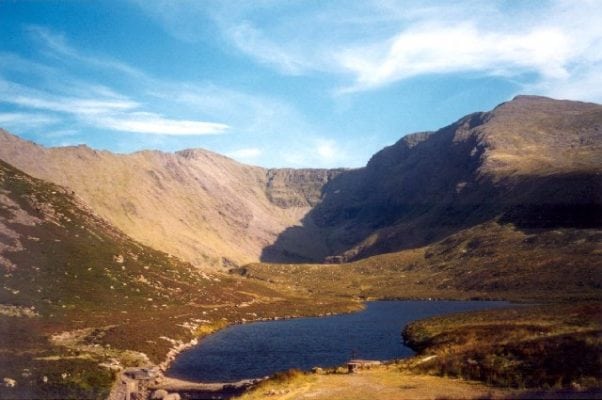
The route starts from the new Concrete or Hydro Road car par. This road is a bit of a slog but when you reach Lough Eighter you have a great view of Carrauntoohil up the Coomloughra Glen. From here the walk up the glen is relatively flat on the northern (left) side of Coomloughta Lough and Lough Eagher until you reach the grassy slopes at the bottom of the Black Mare Gully. As you ascend three obvious gullies are visable all of which lead to the ridge which is only 300m (15mins) southwest of the summit.
From the summit you head back southwest along the same route follow the well worn Caher Ridge passing the summits of Caher (1,001m) and Caher West Top (975m) before decending the the lower slopes of Caher and reaching Lough Eighter to take the Hydro Road back to the car park.
There are plenty of other routes to suit walkers and climbers of all experience, from beginners to advanced on the Reeks, so please find a route in the list below that is right for you or your group. Plan your walk by checking the weather, sunrise sunset times and our hiking checklist on our website https://www.activeme.ie/useful-info/planning-a-trip/. Please remember that you are only as fast as the slowest member of your group!
Use our Map of Ireland and Sat Nav tool to get directions to the start point and our detailed maps and GPS on our ActiveME iPhone App and Android App to find and follow the walking route live on screen and keep on track. At all times, our maps and App should be used in conjunction with proper map and compass navigation techniques. Feel free to send us your photos and add you own star rating, comments or suggestions below.
Gallery
The Black Mare and Caher loop walk is a moderate to strenuous 5 to 6 hour (12 km) walking route to the summit of Irelands highest mountain, Carrauntoohil (1,039m) via the steep Black Mare Gully at the eastern end of the Coomloughra Glen and returning along the Caher Mountain (1,001m) ridge. Although this route is steep it is one of the safer ascents to Carrauntoohil using this grassy gully.
It is not advised to attempt this accent when icy as the slope is both steep and north facing. You are also advised not to decend this route due to its steep nature.
The route starts from the new Concrete or Hydro Road car par. This road is a bit of a slog but when you reach Lough Eighter you have a great view of Carrauntoohil up the Coomloughra Glen. From here the walk up the glen is relatively flat on the northern (left) side of Coomloughta Lough and Lough Eagher until you reach the grassy slopes at the bottom of the Black Mare Gully. As you ascend three obvious gullies are visable all of which lead to the ridge which is only 300m (15mins) southwest of the summit.
From the summit you head back southwest along the same route follow the well worn Caher Ridge passing the summits of Caher (1,001m) and Caher West Top (975m) before decending the the lower slopes of Caher and reaching Lough Eighter to take the Hydro Road back to the car park.
There are plenty of other routes to suit walkers and climbers of all experience, from beginners to advanced on the Reeks, so please find a route in the list below that is right for you or your group. Plan your walk by checking the weather, sunrise sunset times and our hiking checklist on our website https://www.activeme.ie/useful-info/planning-a-trip/. Please remember that you are only as fast as the slowest member of your group!
Use our Map of Ireland and Sat Nav tool to get directions to the start point and our detailed maps and GPS on our ActiveME iPhone App and Android App to find and follow the walking route live on screen and keep on track. At all times, our maps and App should be used in conjunction with proper map and compass navigation techniques. Feel free to send us your photos and add you own star rating, comments or suggestions below.


