- Created: February 17, 2014 11:30 pm
- Updated: June 24, 2022 10:34 am
- Distance Instructions
- Distance 7 km
- Time 0 s
- Speed 0.0 km/h
- Min altitude 147 m
- Peak 1000 m
- Climb 859 m
- Descent 6 m
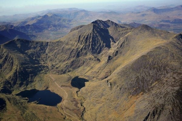
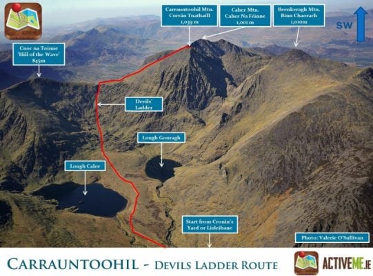
The climb to the summit of Carrauntoohil, Irelands highest mountain at 1,039m is one of the most rewarding in Ireland. This Carrauntoohil trail is a strenuous 4 to 6 hour (12km) walking route via the Devils Ladder on the MacGillycuddys Reeks Mountains, Co. Kerry in the south west of Ireland. The route map below shows the ascent only as the decent is along the same route.
Irish and mountain weather is nothing but unpredictable and weather, visibility and temperature can change in minutes. The Carrauntoohil route map is an illustrative guide and should NOT be used for navigation. At all times, our maps should only be used in conjunction with proper map and compass navigation techniques and mountain walking experience. There are plenty of other routes to suit beginners in the area, so please find a route that is right for you or your group or better still, Get a Guide if unsure. Why take a guide? While you get to experience the thrill of climbing to the summit and admiring the scenery, a guide can help bring the place to life with local history, mythology and stories of the area. Most importantly, a guide knows the route, will give comfort to those with little mountain experience and make your day more enjoyable.
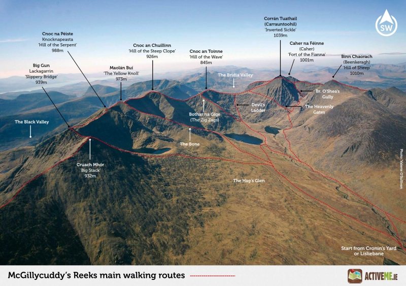
Although the Devils Ladder has been eroded in the past few years, it is still the most popular, direct and shortest route to the summit of Carrauntoohil from the historic starting point of Cronins Yard (Lisleibane is an alternative). The route is not considered the most interesting but it is the most straightforward trail to the summit as the path is obvious on both the ascent and decent. Look out for loose stones on the ladder and keep safe distance from other groups in case of falling stones.
Click here to book a walking guide with Piaras from Kerry Climbing
From Cronin’s Yard, follow the well worn and obvious path into the stunning Hags Glen with Carrauntoohil rising majestically above. You will pass a number of new steel bridges over the Gaddagh River and some smaller streams. It is difficult to go wrong here as the path is very obvious. Use the large stepping stones to cross the river. Care is advised during river crossings, particularly during or after heavy rains. At a point just before these stepping stones, you can turn right if you want to do the O’Sheas Gully or other Gully routes. Again, a guide is advised for these routes.
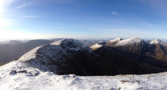
From the stepping stones continue along the path until you reach the base of the Devils Ladder. At the top of the ladder turn right and follow the well worn path and stone piles to the summit and take care when leaving the summit to retrace your steps and find the path, especially if visibility is poor. Be sure to use your map and compass and don't be afraid to ask others or better still hire a Guide. Click here to see a panoramic photo from the summit
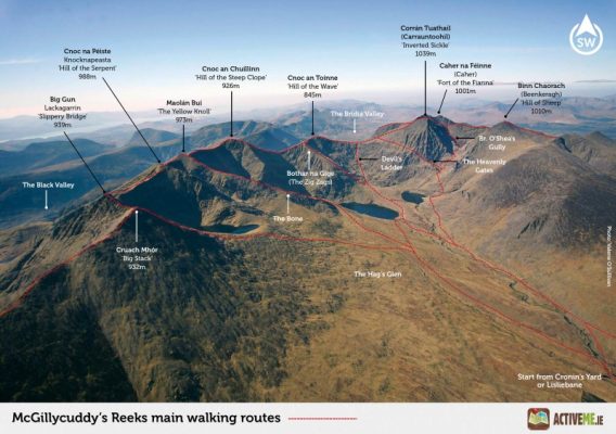
Irish and mountain weather is nothing but unpredictable and weather, visibility and temperature can change in minutes. There are plenty of other routes to suit beginners to advanced walkers in the summit of Carrauntoohil mountain and in the surrounding area, so please find a route that is right for you or your group. Some other popular routes include:
- Coomloughra Horseshoe Loop Walk to Carrauntoohil taking in Caher and Beenkeragh Mtns.
- Carrauntoohil via The Bone and down the Heavenly Gates
- Carrauntoohil via O'Shea's Gully and down the Zig Zags
- MacGillyCuddy's Reeks Entire Mountain Range Walk
- Caher and Carrauntoohil from the Hydro Road
- Carrauntoohil and Caher Mtn's from the Lack Road and Bridia Valley
- Many many more
Plan your walk by checking the weather, sunrise sunset times and our hiking checklist on our website https://www.activeme.ie/useful-info/planning-a-trip/. Please remember that you are only as fast as the slowest member of your group! If the weather is poor don't be afraid to cancel your walk and do some other walk, maybe a low level walk.
Use our Map tool to get directions to the start point but our maps should only be used in conjunction with proper map and compass navigation techniques.
The climb to the summit of Carrauntoohil, Irelands highest mountain at 1,039m is one of the most rewarding in Ireland. This Carrauntoohil trail is a strenuous 4 to 6 hour (12km) walking route via the Devils Ladder on the MacGillycuddys Reeks Mountains, Co. Kerry in the south west of Ireland. The route map below shows the ascent only as the decent is along the same route.
Irish and mountain weather is nothing but unpredictable and weather, visibility and temperature can change in minutes. The Carrauntoohil route map is an illustrative guide and should NOT be used for navigation. At all times, our maps should only be used in conjunction with proper map and compass navigation techniques and mountain walking experience. There are plenty of other routes to suit beginners in the area, so please find a route that is right for you or your group or better still, Get a Guide if unsure. Why take a guide? While you get to experience the thrill of climbing to the summit and admiring the scenery, a guide can help bring the place to life with local history, mythology and stories of the area. Most importantly, a guide knows the route, will give comfort to those with little mountain experience and make your day more enjoyable.
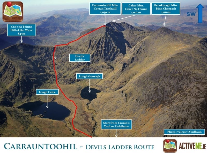
Although the Devils Ladder has been eroded in the past few years, it is still the most popular, direct and shortest route to the summit of Carrauntoohil from the historic starting point of Cronins Yard (Lisleibane is an alternative). The route is not considered the most interesting but it is the most straightforward trail to the summit as the path is obvious on both the ascent and decent. Look out for loose stones on the ladder and keep safe distance from other groups in case of falling stones.
Click here to book a walking guide with Piaras from Kerry Climbing
From Cronin’s Yard, follow the well worn and obvious path into the stunning Hags Glen with Carrauntoohil rising majestically above. You will pass a number of new steel bridges over the Gaddagh River and some smaller streams. It is difficult to go wrong here as the path is very obvious. Use the large stepping stones to cross the river. Care is advised during river crossings, particularly during or after heavy rains. At a point just before these stepping stones, you can turn right if you want to do the O’Sheas Gully or other Gully routes. Again, a guide is advised for these routes.
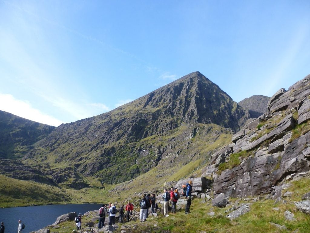
From the stepping stones continue along the path until you reach the base of the Devils Ladder. At the top of the ladder turn right and follow the well worn path and stone piles to the summit and take care when leaving the summit to retrace your steps and find the path, especially if visibility is poor. Be sure to use your map and compass and don’t be afraid to ask others or better still hire a Guide. Click here to see a panoramic photo from the summit
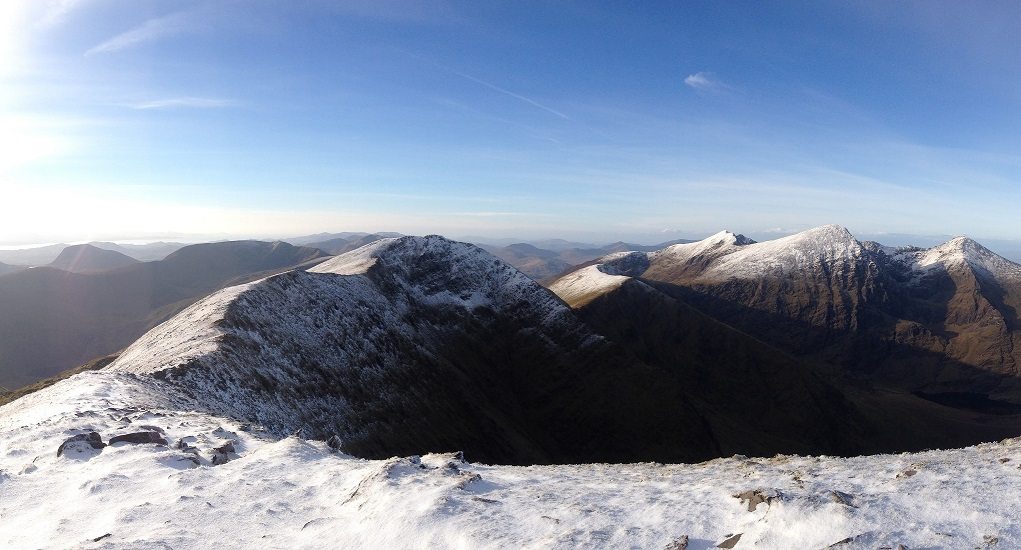
Irish and mountain weather is nothing but unpredictable and weather, visibility and temperature can change in minutes. There are plenty of other routes to suit beginners to advanced walkers in the summit of Carrauntoohil mountain and in the surrounding area, so please find a route that is right for you or your group. Some other popular routes include:
- Coomloughra Horseshoe Loop Walk to Carrauntoohil taking in Caher and Beenkeragh Mtns.
- Carrauntoohil via The Bone and down the Heavenly Gates
- Carrauntoohil via O’Shea’s Gully and down the Zig Zags
- MacGillyCuddy’s Reeks Entire Mountain Range Walk
- Caher and Carrauntoohil from the Hydro Road
- Carrauntoohil and Caher Mtn’s from the Lack Road and Bridia Valley
- Many many more
Plan your walk by checking the weather, sunrise sunset times and our hiking checklist on our website https://www.activeme.ie/useful-info/planning-a-trip/. Please remember that you are only as fast as the slowest member of your group! If the weather is poor don’t be afraid to cancel your walk and do some other walk, maybe a low level walk.
Use our Map tool to get directions to the start point but our maps should only be used in conjunction with proper map and compass navigation techniques.


