- Created: August 28, 2012 11:34 am
- Updated: March 12, 2018 2:31 pm
Categories:
Location: Mayo
- Distance Instructions
Label
- Distance 0 m
- Time 0 s
- Speed 0.0 km/h
- Min altitude 0 m
- Peak 0 m
- Climb 0 m
- Descent 0 m
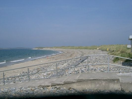
Bertra Beach is an exposed shingle and sand beach located 12km west of Westport off the R335 to Louisburgh near the foot of Croagh Patrick. It is a very popular beach for swimming, walking, bird-watching, kite surfing and windsurfing. The beach has a lifeguard in the summer months and there are toilets. The northeastern point of the beach, farthest away from the carpark, is a popular spot for shore-angling. There are important sand dunes present which have been colonised by many different plant and bird species.
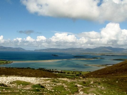
Clew Bay is an area of international scientific importance due to its geomorphical significance as one of the few DROWNED DRUMLIN landscapes in the world. Drumlins are low, elongated hills composed of glacially deposited materials and usually occur in fields or “swarms”. Their shape indicates the direction of ice flow with the steeper, blunt end facing the direction from which the ice came. The Clew Bay field was submerged when the ice caps melted, causing the sea level to rise. The westernmost drumlins have been almost completely eroded by the force of the Atlantic waves. The outer drumlin islands have steep seaward facing cliffs of boulder clay but much of the eroded material has been redeposited in the form of shingle spits, tombolos and forelands. Some of these spits link the western islands to create a distinctive coastal pattern and protect the inner drumlin islands from the Atlantic waves.
Gallery
Bertra Beach is an exposed shingle and sand beach located 12km west of Westport off the R335 to Louisburgh near the foot of Croagh Patrick. It is a very popular beach for swimming, walking, bird-watching, kite surfing and windsurfing. The beach has a lifeguard in the summer months and there are toilets. The northeastern point of the beach, farthest away from the carpark, is a popular spot for shore-angling. There are important sand dunes present which have been colonised by many different plant and bird species.
Clew Bay is an area of international scientific importance due to its geomorphical significance as one of the few DROWNED DRUMLIN landscapes in the world. Drumlins are low, elongated hills composed of glacially deposited materials and usually occur in fields or “swarms”. Their shape indicates the direction of ice flow with the steeper, blunt end facing the direction from which the ice came. The Clew Bay field was submerged when the ice caps melted, causing the sea level to rise. The westernmost drumlins have been almost completely eroded by the force of the Atlantic waves. The outer drumlin islands have steep seaward facing cliffs of boulder clay but much of the eroded material has been redeposited in the form of shingle spits, tombolos and forelands. Some of these spits link the western islands to create a distinctive coastal pattern and protect the inner drumlin islands from the Atlantic waves.


