- Created: April 30, 2013 7:42 pm
- Updated: December 12, 2017 10:59 am
- Distance Instructions
- Distance 67 m
- Time 0 s
- Speed 0.0 km/h
- Min altitude 5 m
- Peak 6 m
- Climb 0 m
- Descent 0 m
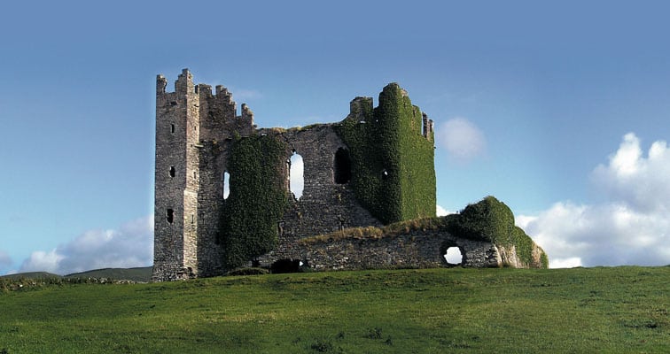
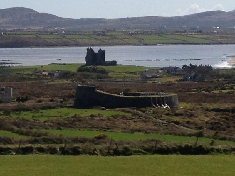
Ballycarbery meaning ’Village of Carbery’ so called after Cairbre O’Shea, head of one of the Corca Dhuibhne clans. The Corca Dhuibhne Clans held control of Iveragh from c. 500 to 1300 AD until they were over-thrown by the powerful MacCarthy clan who held the lands around Killarney. Donal MacCarthy Mor built the castle and it was a perfect location for a stronghold with clear views of Valentia Harbour, Portmagee Channel and the waters of the river right up to Cahersiveen.
Ballycarbery meaning ’Village of Carbery’ so called after Cairbre O’Shea, head of one of the Corca Dhuibhne clans. The Corca Dhuibhne Clans held control of Iveragh from c. 500 to 1300 AD until they were over-thrown by the powerful MacCarthy clan who held the lands around Killarney. Donal MacCarthy Mor built the castle and it was a perfect location for a stronghold with clear views of Valentia Harbour, Portmagee Channel and the waters of the river right up to Cahersiveen.
